
GIS
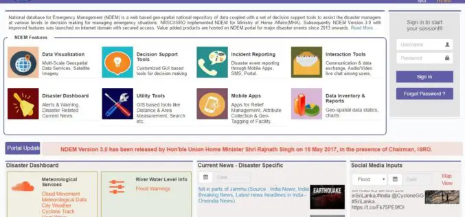
ISRO Released National Database for Emergency Management (NDEM) Version 3.0 Released
The National Database for Emergency Management (NDEM) Version 1.0 was operationalised in 2013. Subsequently, NDEM Version 2.0 was launched in 2015 with improved features like multi-scale databases, decision-support tools and

NASA Scientists Developed Technology to Help Drones Land Safely
PTI – WASHINGTON: NASA scientists have developed a new software that will help drones automatically spot the best places to crash-land in case of an emergency, without hurting anyone on
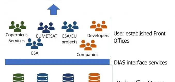
The Upcoming Copernicus Data and Information Access Services (DIAS)
The European Commission (EC) has launched an initiative to develop Copernicus Data and Information Access Services (DIAS) that facilitate access to Copernicus data and information from the Copernicus services. By

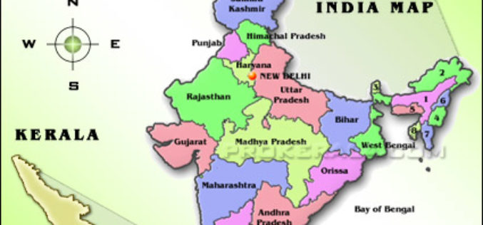
Explore Places of Tourist Interest – Ajmer City
Contributed By:- Ajmer, located in the Ajmer District of Rajasthan is the 5th largest city of the state, and is located at a distance of 135 km from the capital
Space-based Services Should be Used: Kerala Tourism Minister
Thiruvananthapuram, May 19 (PTI) Applications of space-based services should be used by government agencies and departments for betterment of administration and society, Kerala Tourism and Devaswom Minister Kadakampally Surendran said

Maharashtra Government to Spend INR 260 Crore for GIS Mapping of ULBs
According to recent news by TOI – The state cabinet on Tuesday sanctioned Rs 260 crore for GIS mapping(Geographic Information System) of all the C and D municipal corporations, Councils

Varanasi the Spiritual Capital of India – a Journey Through Esri Story Map
Contributed By:- Varanasi (Kashi or Banaras) is a city in the northern Indian state of Uttar Pradesh dating to the 11th century B.C. Regarded as the spiritual capital of India,
ISRO to Set up Geospatial Outreach Research Facility in Hyderabad
The Indian Space Research Organisation (ISRO) will set up an outreach facility in Hyderabad, Telangana and it is a matter of pride for the state to be given this research centre.

Odisha Government Includes 7 Kharif Crops Under PMFBY Insurance
According to recent news by the Outlook, Odisha government has recently decided to include seven major crops – paddy, groundnut, cotton, turmeric, ginger, red-gram (arhar) and maize – under the
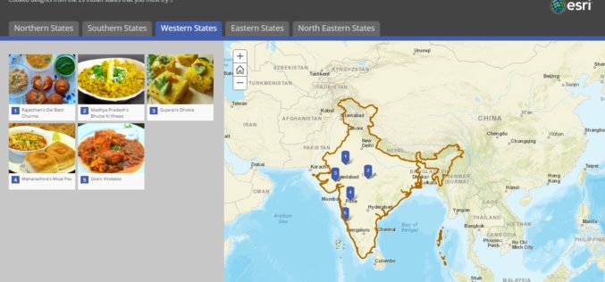
Story Map – Food Specialties of India
Contributed By:- Indian food is different from rest of the world not only in taste but also in cooking methods. It reflects a perfect blend of various cultures and ages.
