
GIS

Satellite Mapping of Kedarnath to Boost Tourism
According to recent news by the Hindustan Times, the state government of Uttrakhand is set to conduct mapping of Kedarnath area, including the famed shrine town, using high-resolution satellite images

Glimpse of The Dandi March Through Esri Story Map
The Salt March, also mainly known as the Salt Satyagraha, began with the Dandi March on 12 March 1930 and was an important part of the Indian independence movement. The

Pix4Dmapper 3.2 Now Generates Tiled Level-of-Detail (LoD) Mesh
May 2, 2017 – Today, we are happy to announce our Pix4Dmapper Desktop 3.2 release. The new version has great advancement in stability and usability – Upload desktop projects to cloud

Uttar Pradesh: New Government Schools Only After GIS Mapping
Uttar Pradesh, India – According to recent news by The Hindustan Times, Uttar Pradesh will now get new government-run primary and upper primary schools only after completion of Geographic Information System
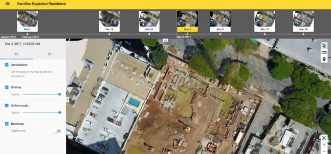
More efficient construction management with Pix4Dbim
More efficient construction management with Pix4Dbim The importance of easy data visualization for Jobsite documentation Project info Project Description A volcanic archipelago in the Central Pacific of only 11,000 square miles, Hawaii
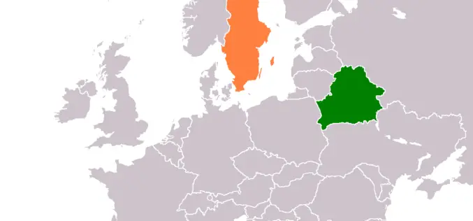
Belarus, Sweden to Share Experience in GIS Development
MINSK, 26 April (BelTA) – Belarus and Sweden will exchange experience in geographic information systems (GIS) development, BelTA learned from Belarus’ State Property Committee. A delegation of specialists of the
University of Guelph: Prof. John Lindsay Develops Whitebox Geospatial Analysis Tools for Processing Geospatial Data
Professor John Lindsay has developed a one-of-a-kind software package called Whitebox Geospatial Analysis Tools for processing geospatial data that he says has put the University of Guelph on the map

China Unveils Results of First National Geoinformation Survey
China boasts a total of 7.56 million square kilometers of vegetation cover, while buildings cover 153,000 square kilometers of land, the State Council Information Office unveiled at a news briefing
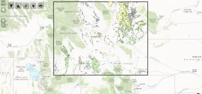
WSGS Completes First Update to Online Oil and Gas Map since its Launch in July
The Wyoming State Geological Survey (WSGS) has completed the first update to its online Oil and Gas Map of Wyoming, including revising the map’s data and improving its functionality. The
China Draws 3D Topographic Map of Antarctic Seabed
Chinese scientists have created a three-dimensional, digital topographic map of the Antarctic seabed using data collected during a recent expedition. The map was presented at a press briefing held Friday
