
GIS

IARPA Announces the Multi-View Stereo 3D Mapping Challenge
Washington, D.C. – As reported in a recent press release by the Ofice of the Director of National Intelligence, the Intelligence Advanced Research Projects Activity (IARPA), within the Office of
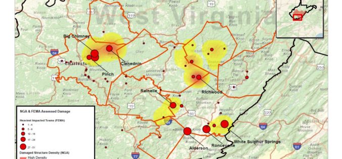
National Geospatial-Intelligence Agency Provides Expertise Response to West Virginia Flooding
As reported in a recent news bulletin by The National Geospatial-Intelligence Agency (NGA), NGA is providing geospatial expertise and damage assessments to the Federal Emergency Management Agency (FEMA) for flooded

GPS and Satellite Mapping Technology to Monitor the Forest Cover
Maharashtra, India – Maharashtra government will use Global Positioning System (GPS) and satellite mapping technology to monitor the forest cover in the state. “The government will use GPS and satellite
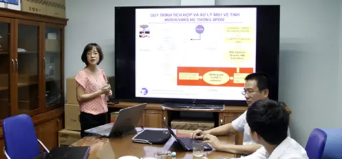
Scientists Develop Air-pollution Warning Software Using Satellite Images
Vietnam – According to recent news by the VietNamNet Bridge, Scientists from the Hanoi University of Engineering & Technology, a member school of Hanoi National University, have invented an air pollution warning

China Estimates Decline in Summer Crop Yield
According to recent news by The Institute of Remote Sensing and Digital Earth (RADI) under the Chinese Academy of Sciences (CAS), China’s summer crop yield is set to drop for

Singapore Land Authority 3D Smart Nation Map Debuts on the World Stage
The Singapore Land Authority (SLA) has revealed the highly anticipated first phase of its national 3D mapping project to an audience of more than 16,500 of the world’s leading geospatial

Use Modern Technology for Timely, Accurate Agriculture Data
New Delhi, Jun 29 (PTI) With time lag in agri-data hindering the policy making process, Agriculture Minister Radha Mohan Singh today asked the Statistics Ministry to use modern technologies like
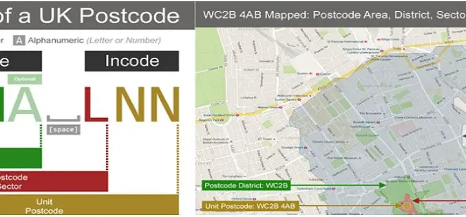
Understanding UK Postcodes and Using Them in Geospatial Systems
Contributed By:- Postcodes are very powerful within UK data – if you know the postcode of a geographical entity, you can geocode it, reasonably accurately, and using open and reliable

What’s New in ArcGIS Earth 1.2
ArcGIS Earth is off to a great start with thousands of downloads and an engaged community of global users. We are happy to release the 1.2 version and excited to
ISRO to Geo-tag Assets Created Under MGNREGA
India – According to recent news, a Memorandum of Understanding was signed between the Rural Development Ministry and ISRO, Department of Space for geo-tagging the assets created under MGNREGA in
