
GIS

Chandigarh to Launch Web GIS Service for Distributing Properties
According to recent news by The Indian Express, the Chandigarh Administration is all set to launch a web GIS service enabling families to distribute their properties online. The move is
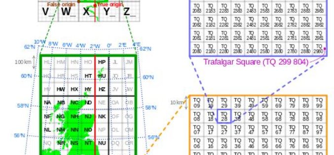
Is Britain on the move?
Australia has recently announced a 1.8m shift in its mapping coordinates, to compensate for the country’s 7.5cm shift north each year. Inevitably the question is why, and could the same
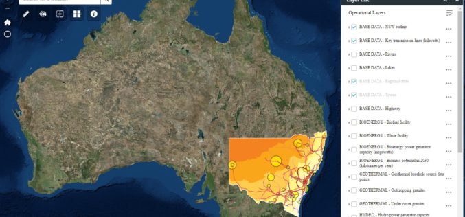
New South Wales Government Launches Renewable Energy Resources Map
In a recent news release by the New South Wales Government, in a state first, NSW will have a renewal energy map to help drive investment in new renewable projects across
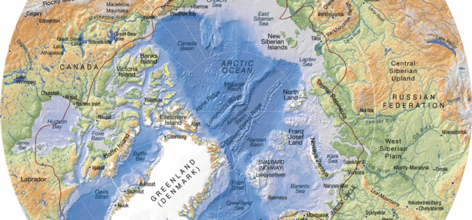
Federal Agency for Geodesy and Cartography Commissioned New Project to Compile New Arctic Atlas
The Federal Agency for Geodesy and Cartography commissioned a project to compile and publish a national atlas of the Russian Arctic, according to a RIA Novosti report. The entire project was estimated at 80 million

Egypt to Map Archaeological Sites
A map of all of Egypt’s archaeological sites and museums has been created and will be launched for the first time on sites around the country The Geographic Information System
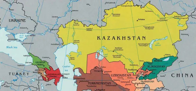
Kazakhstan is Planning to Create a National Geographical Information System
According to recent news by the Kazakh TV, Kazakhstan is planning to create a national geographical information system, which will automate a number of public services related to spatial data, such as
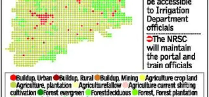
Telangana Goes for Geo-tagging With the Help of NRSC and ICRISAT
According to recent news by The Hindu, soon the citizens, farmers, administrators and policy makers can gain access to information about water availability and cropping pattern in all irrigation systems
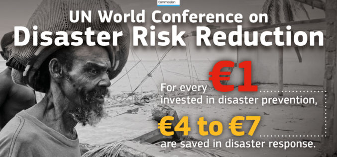
Sendai Framework for Disaster Risk Reduction
The Sendai Framework for Disaster Risk Reduction 2015-2030 provides a new global approach to disaster risk management policy and operations. In June 2016, the European Commission published an action plan
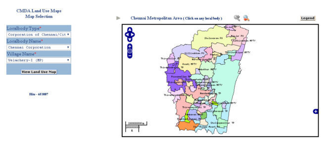
CMDA Uses GIS Based Land Use Information System for Information Dissemination
According to recent news by ToI, the Chennai Metropolitan Development Authority (CMDA) has launched a web portal to swiftly extract land-use data under the CMDA administrative area at various sites
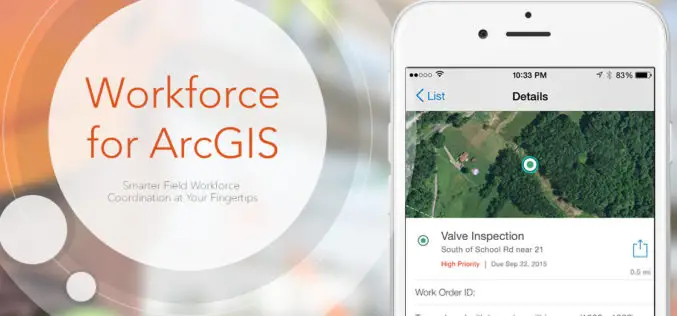
Esri Announces Workforce for ArcGIS
Esri has announced the release of Workforce for ArcGIS. Workforce for ArcGIS enables a common view in the field and the office. Get the right worker to the right place with the
