
LiDAR

Purana Qila LiDAR Survey to Guide ASI’s New Excavation in Search of Indraprastha
The Archaeological Survey of India (ASI) is set to resume its excavation efforts at Purana Qila, one of Delhi’s most significant archaeological sites, in search of evidence related to Indraprastha,
LiDAR in Traffic Management: UDOT’s Plan for Safer Intersections
The Utah Department of Transportation (UDOT) is spearheading an innovative project that leverages LiDAR in traffic management to enhance safety and efficiency at key intersections. Launched in March 2024, this
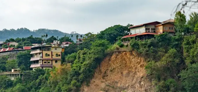
LiDAR Survey for Landslide Risk Management in Uttarakhand
In a recent executive committee meeting of the Uttarakhand Landslide Reduction and Management Centre (ULMMC), Chief Secretary Radha Raturi underscored the urgency of bolstering landslide management and mitigation efforts in
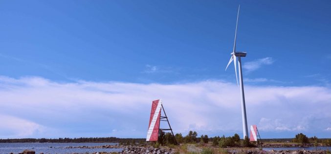
Azerbaijan Exploring Offshore Wind Potential with LiDAR Technology
Azerbaijan has significantly advanced its renewable energy initiatives with the launch of a LiDAR (Light Detection and Ranging) project designed to measure offshore wind potential in the Caspian Sea. This

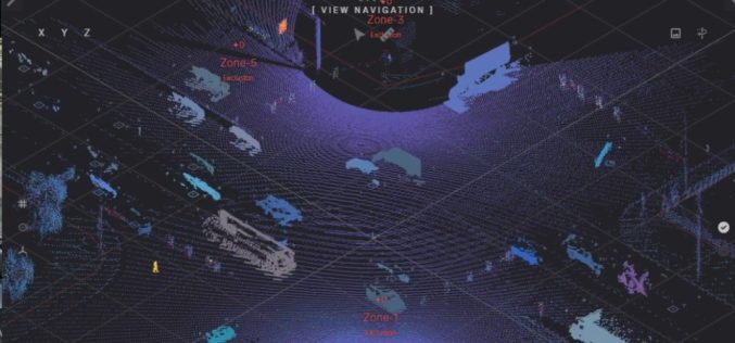
Northeast Frontier Railway (NFR) to Conduct Airborne LiDAR Survey
The Indian Railway’s Northeast Frontier Railway (NFR) zone is set to conduct an Airborne LiDAR Survey on the Lumding to Badarpur hill section. This advanced survey will take place during

Reality Tech Takes on History: Hexagon Builds Digital Twin of Qutub Shahi Tombs
Global leader in reality technology, Hexagon, unveiled a detailed digital replica of the historic Qutub Shahi Tombs to the Telangana government. This “proof-of-concept” demonstrates the potential of Hexagon‘s “Reality Technology
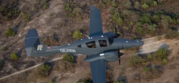
RIEGL Expands Test Aircraft Fleet with a New DA62 SurveyStar
RIEGL Laser Measurement Systems GmbH, a global leader in the development and production of laser scanners and systems for applications in surveying, and in cooperation with Diamond Aircraft Austria since

Discover How Terra Modus Utilized 3D Laser Scanning Technology to Measure and Model the Stormwater System of a European Capital City in Just 6 Months
In this 3D laser scanning case study you will discover how Terra Modus, a company specialising in 3D laser scanning and photogrammetry, tackled the challenge of measuring the largest stormwater
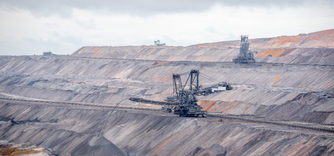
Revolutionizing Mine Surveying with Remote LiDAR Surveys via Internet: Drone-in-a-Box Technology
Remote mine LiDAR surveys via the internet (drone-in-a-box) is a technology that allows for the remote surveying of mines using LiDAR (Light Detection and Ranging) technology. This technology involves the
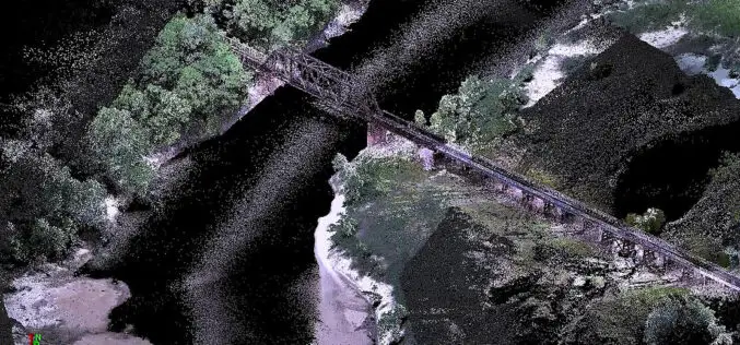
Drone LiDAR for River Scour Survey
Rivers are constantly changing natural systems, and understanding their dynamics is crucial for effective management and planning. One important aspect of river systems is scoured, which refers to the erosion
