
LiDAR
Telangana Launches LiDAR Survey for One Map Hyderabad
The Telangana government has initiated the One Map Hyderabad project, a large-scale LiDAR survey aimed at improving urban planning and infrastructure management. This project will consolidate critical urban data, such
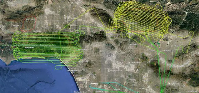
NV5 Releases LiDAR Data to Aid Los Angeles Wildfire Recovery
NV5, a leading provider of geospatial solutions, has released lidar data for the Palisades Fire and Eaton Fire burn areas. The dataset, made publicly available through the U.S. Geological Survey
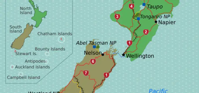
New Zealand Coastal Mapping Project Uses LiDAR for Protection
In a significant move to combat the impacts of climate change, Toitū Te Whenua Land Information New Zealand (LINZ) has initiated a comprehensive project to map large portions of the

Fugro Expands Seafloor Mapping Efforts for Florida’s Coast
Fugro is playing a bigger role in the Florida Seafloor Mapping Initiative (FSMI), led by the Florida Department of Environmental Protection (DEP). This long-term seafloor mapping project aims to map
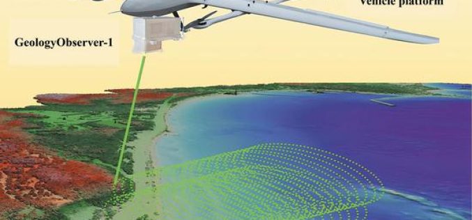
China’s GeologyObserver-1 Revolutionizes 3D Mapping
Chinese researchers have unveiled the GeologyObserver-1, a cutting-edge airborne device designed to create precise 3D surface models of both terrestrial and aquatic environments. This breakthrough is expected to transform environmental
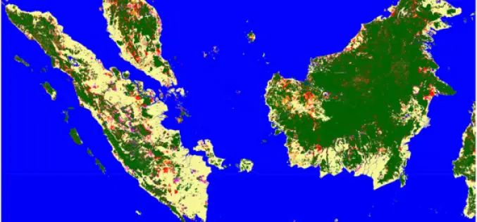
Advanced Mapping Reveals Indonesia New Islands
In 2024, Indonesia’s Geospatial Information Agency (BIG) identified 63 new islands, bringing the nation’s total to 17,380 officially recognized islands. These newly discovered islands are located in the waters of

LiDAR Technology Uncovers Hidden Silk Road Cities in Uzbekistan
Recent advancements in LiDAR (Light Detection and Ranging) technology have revealed hidden remnants of Silk Road cities in Uzbekistan, uncovering archaeological treasures that had remained buried for centuries. The discovery

Purana Qila LiDAR Survey to Guide ASI’s New Excavation in Search of Indraprastha
The Archaeological Survey of India (ASI) is set to resume its excavation efforts at Purana Qila, one of Delhi’s most significant archaeological sites, in search of evidence related to Indraprastha,
LiDAR in Traffic Management: UDOT’s Plan for Safer Intersections
The Utah Department of Transportation (UDOT) is spearheading an innovative project that leverages LiDAR in traffic management to enhance safety and efficiency at key intersections. Launched in March 2024, this
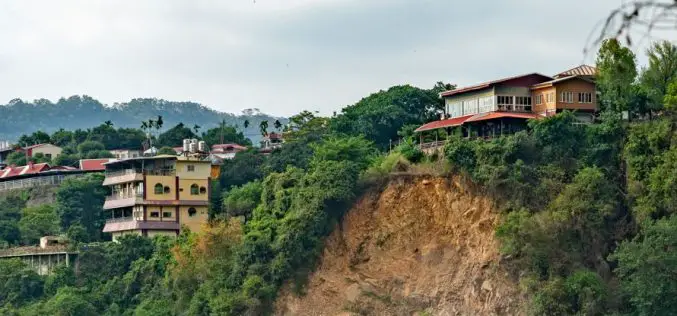
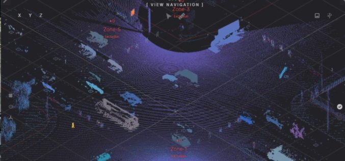
LiDAR Survey for Landslide Risk Management in Uttarakhand
In a recent executive committee meeting of the Uttarakhand Landslide Reduction and Management Centre (ULMMC), Chief Secretary Radha Raturi underscored the urgency of bolstering landslide management and mitigation efforts in
