In 2024, Indonesia’s Geospatial Information Agency (BIG) identified 63 new islands, bringing the nation’s total to 17,380 officially recognized islands. These newly discovered islands are located in the waters of Bangka Belitung, Southeast Sulawesi, North Maluku, and West Kalimantan. The identification highlights the nation’s growing database of Indonesia new islands.
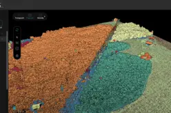
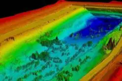
The identification process involved advanced technologies such as light detection and ranging (LiDAR) and satellite imaging. These tools enabled researchers from BIG, along with government ministries and local authorities, to detect islands that had previously remained unnoticed due to their isolated locations. Such technologies play a pivotal role in uncovering Indonesia new islands.
To be officially recognized, these islands met four specific criteria mandated by national regulations on spatial planning:
- A maximum land area of 2,000 square meters.
- Natural formation, not resulting from artificial reclamation.
- Being surrounded by water.
- Remaining above the highest tide level.
Also Read – Indonesia Launches Geospatial Portal for Forest Monitoring and Protection
BIG Chairperson Muh. Aris Marfai emphasized that this discovery represents significant progress in Indonesia’s geospatial data management. Accurate geospatial information is crucial for optimizing natural resources for the benefit of the people and for preventing territorial claims by external parties. Marfai urged all stakeholders, including the public, government, and academic community, to refer to the official data provided by BIG. The updated records of Indonesia new islands ensure that the country maintains precise control of its territories.
Historically, the number of officially recorded islands in Indonesia has been increasing:
- 16,771 islands in 2020.
- 17,024 islands in 2022.
- 17,374 islands in 2023.
The latest update to 17,380 islands in 2024 followed evaluations and reclassifications conducted by the agency, which corrected misidentifications from earlier findings.
This achievement aligns with BIG’s ongoing efforts to enhance the quality of Indonesia’s geospatial maps. The agency has set a target to improve the quality of the nation’s basic geospatial map to be equivalent to Google Maps by 2029. This goal is expected to be achieved with support from relevant ministries, agencies, local governments, and the community.
The discovery of these new islands not only adds to Indonesia’s rich archipelagic tapestry but also underscores the importance of advanced geospatial technologies in uncovering and documenting the nation’s natural assets. As the world’s largest archipelagic country, Indonesia’s commitment to accurate geospatial data is vital for sustainable development, resource management, and national sovereignty.
Source: Antara News