
Remote Sensing

Iran to Launch Indigenous Built Remote Sensing Satellite Next Year
According to the latest news by Tasnim News Agency, Iran plans to send its first indigenous built remote sensing satellite “Tolou 1” into orbit by the first half next year.
China Launches its First Commercial Mission Jilin-1
China has entered into commercial market of remote sensing with the launch of the Jilin – 1 mission. China has recently launched Jilin-1 mission carrying four satellites on Oct. 7,

Geospatial Research Program Seeks Project Applications
FAYETTEVILLE, Ark. – The Spatial Archaeometry Research Collaborations (SPARC) Program, a National Science Foundation-funded initiative at the Center for Advanced Spatial Technologies at the University of Arkansas, is accepting applications
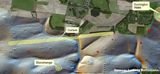
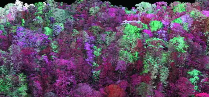
Geospatial Technology Helps To Find Remains of Major New Prehistoric Stone Monument
A team of researchers has found the remains of a major new prehistoric stone monument. They have been discovered less than 3 kilometres from Stonehenge. Using cutting edge, multi-sensor technologies
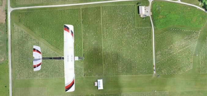
Kansas State University and Precisionhawk Developing UAS App That Predicts Corn Production
Kansas State University has recently signed a research partnership with PrecisionHawk Inc., a Raleigh, North Carolina, to develop unmanned aerial systems or UAS app that predicts corn production. The partnership establishes
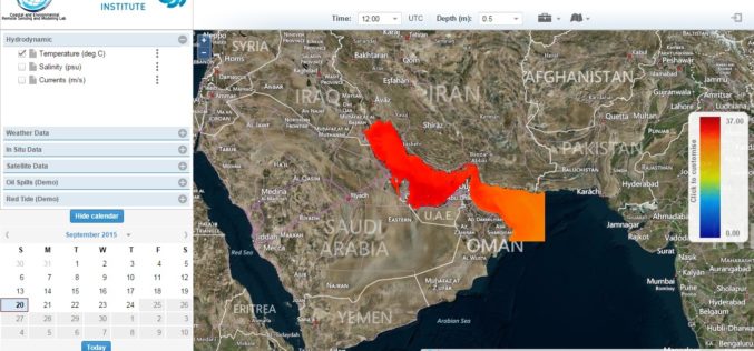
Remote Sensing for Real Time Coastal Monitoring
The Masdar Institute of Science and Technology (MI) has announced that it has launched an environmental regional observatory (http://earth.masdar.ac.ae/), offering comprehensive information for monitoring coastal processes in the UAE and
Laser Based Forest Mapping Instrument for Space Station
Laser-based technology will enable unprecedented measurements of 3-D forest structure A laser-based instrument for mapping the 3-D structure of Earth’s forests has passed a major milestone toward deployment on the
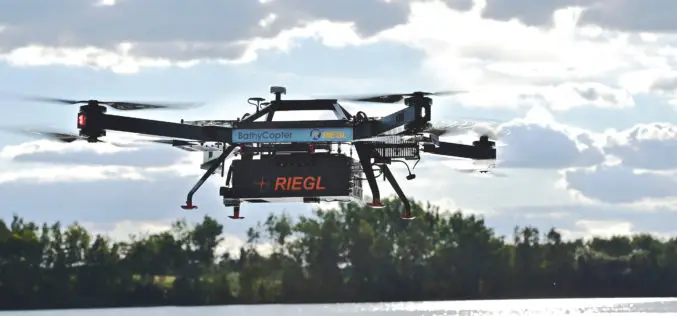
RIEGL with Impressive Display at INTERGEO 2015 in Stuttgart
On the first day of INTERGEO RIEGL delivered an impressive display in Stuttgart! With a special UAV-area at booth E4.079, live demo UAV-flights at the outdoor area, and the unveiling
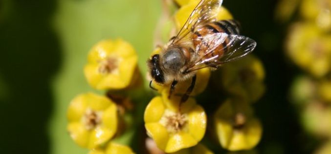
Remote Sensing Technology to Map Flowering Plants
Researchers from Finland, Kenya, South Africa and Sudan have created a flowering map for a semi-arid Savannah site in Africa using a new remote sensing technology. The remote sensing technology combines
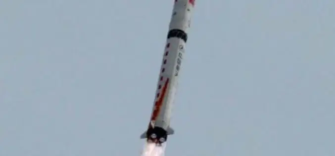
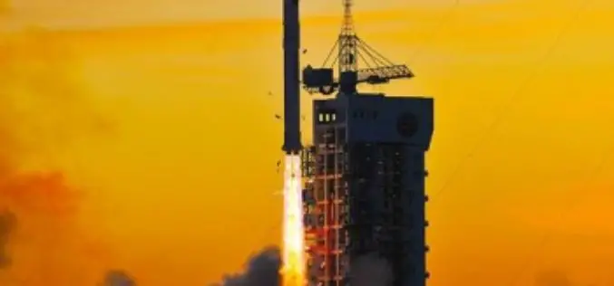
China Launches Gaofen 9 Remote Sensing Satellite
China has launched Gaofen 9 remote sensing satellite at 04:45 UTC on Monday using Long March-2D launch vehicle from the 603 Launch Pad of the LC43 Launch Complex to orbit. It is
