
Software
Mapping and Collecting Geospatial Data with SuperSurv 3.2 (iOS)
Supergeo Technologies Inc, the leading global provider of GIS software and solutions, announced that SuperSurv 3.2 (iOS), professional mobile GIS App, supports French user interface and Lebanese coordinate system. The

PCI Geomatics Releases Linux Versions of Geomatica 2014
RICHMOND HILL, Ontario, Canada—August 7, 2014: PCI Geomatics, a world leading developer of geo-imaging software and systems, today announces the release of three Linux versions of Geomatica 2014, the latest
Explorer for ArcGIS Brings GIS to the Mac
Esri Releases First Native App for Apple OS X July 10, 2014, Redlands, California—Esri today released Explorer for ArcGIS on the Mac, a native OS X application to discover, view, and share maps.

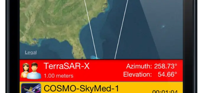
Spymesat Mobile App Now Offers High Resolution Satellite Imagery
Orbit Logic announced today that the iPhone version of their SpyMeSat mobile app will now offer in-app purchase of recent high resolution satellite imagery. SpyMeSat users will be able to use their

Intermap’s GeoPro Server™ Software Application Introduced into the Geospatial Market
– Centerpiece of Intermap’s Orion Platform™ Targets $3.2 Billion Geospatial Software Industry – DENVER, June 27, 2014 – Intermap Technologies (IMP.TO), (ITMSF:BB), a leading provider of location-based solutions, today announced the
SpyMeSat Mobile App Now Offers High Resolution Satellite Imagery
Orbit Logic announced today that the iPhone version of their SpyMeSat mobile app will now offer in-app purchase of recent high resolution satellite imagery. SpyMeSat users will be able to use their
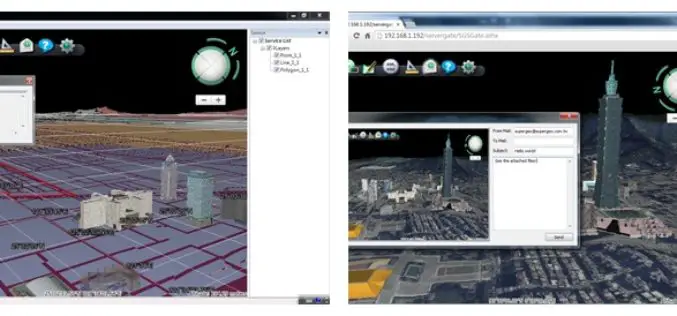
Superior 3D Map Viewing with SuperGIS 3D Earth Server Front-end Applications
To provide users a superior 3D map experience, Supergeo releases whole new front-end applications, the desktop client application, SuperGIS 3D Earth, and the browser plug-in, SuperGIS 3D Earth Plug-in, for

PR: Esri CityEngine Increases the Power of Virtual Design
Esri’s Latest 3D GIS Design Software Makes Working with Complex 3D Urban Environments Easier and Faster Redlands, California—Esri has released CityEngine 2014, the latest version of its advanced 3D GIS urban design

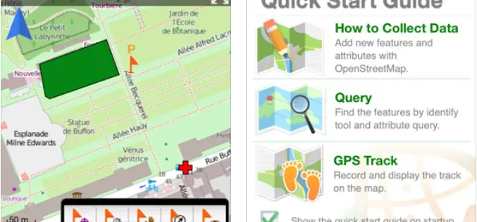
SuperSurv 3.2 for iOS Supports Cloud Storage
SuperSurv 3.2 for iOS, the newest mobile GIS app released by Supergeo, enables users to import data through cloud hard drive and supports more US local coordinate systems, providing iOS
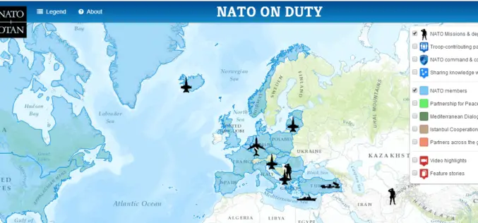
NATO HQ Launches Interactive Web Map Based on Esri Technology
People Can Now Easily View NATO Activities, Operations, Partners, Video, and More Redlands, California—The North Atlantic Treaty Organization (NATO) has just released “NATO on Duty,” an interactive, multi-media web map
