China Developing Water Cycle Observation Satellite to Monitor Hydrological Events
According to recent news by PTI, China will launch its first geoscientific satellite by 2020 for forecasting hydrological events, including floods and droughts.
China announced its plans for the Water Cycle Observation Mission (WCOM) satellite at the International Geoscience and Remote Sensing Symposium (IGRSS) 2016 which kicked off in Beijing yesterday.
The WCOM was initiated jointly by the Institute of Remote Sensing and Digital Earth and the National Space Science Centre with the Chinese Academy of Sciences (CAS). It will be China’s first geoscientific satellite that will give integrated observation of key elements of the global water cycle.
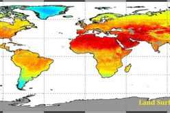
“This year’s floods in southern China are an example of how changes in water cycle have a direct impact on our lives,” Shi Jiancheng, chief WCOM scientist said.
Understanding the distribution characteristics and changing patterns of the water cycle and forecasting them are frontier scientific issues for us, Shi was quoted as saying by state-run Xinhua news agency.
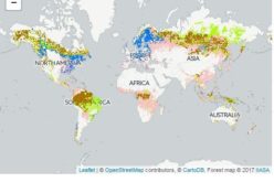
The WCOM will provide unprecedented, accurate observations through simultaneous monitoring of key water cycle elements, such as soil humidity, snow/water equivalents, surface ice and sea water salinity, Shi said.
It will play an important role in flood prevention, drought relief, agriculture, water resource management as well as food and environmental security, he said.
The CAS will cooperate with US and European research teams to initiate a satellite constellation based on the WCOM, aiming to form a worldwide water cycle observation network.
Also at the IGRSS meeting, progress was made in major collaborative research projects, including the China-France Oceanography Satellite (CFOSAT) and the Dragon Program.
The CFOSAT, the first joint satellite development between China and France, scheduled for launch in 2018, is dedicated to ocean wind and wave observation. A prototype model is complete and the actual CFOSAT prototype is being developed.
The CFOSAT will carry two payloads: a wave spectrometer from France and a wind scatterometer by China. It will be the first time for both devices to be used for remote-sensing purpose on satellite.
China is responsible for the satellite design, manufacture and launch.
Scheduled to be completed in 2020, the fourth phase of the Dragon Program consists of 27 projects covering eight fields including agriculture, carbon dioxide monitoring and disaster mitigation.