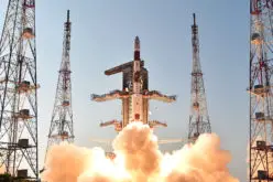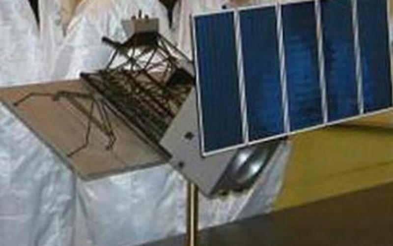
China Launches Successfully Remote Sensing Satellite – Yaogan XVIII
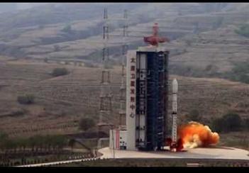
China, Oct 29: The Yaogan XVIII remote-sensing satellite was successfully launched on the back of a Long March 2C carrier rocket from the Taiyuan Satellite Launch Center in north China’s Shanxi Province, according to a press release from the center.
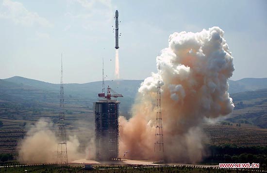
The satellite was launched at 10:50 a.m. on the back of a Long March 2C carrier rocket, according to the center.
The satellite will be used to conduct scientific experiments, carry out land surveys, monitor crop yields and aid in preventing and reducing natural disasters.
As was the case with previous launches of the Yaogan Weixing series, western analysts believe this class of satellites is being used for military purposes.
In fact, three types of satellites use the Yaogan designation. All with a basis for military purposes, these satellites are used for space-based synthetic aperture radar observations, electro-optical observations and naval oceanic surveillance.
The launch marked the 183th mission for the Long March rocket family.
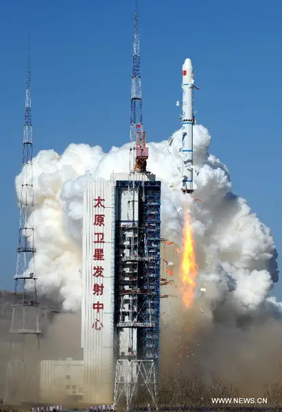
The Chang Zheng 2C (Long March 2C) is a Low Earth Orbit (LEO) launch vehicle derived from DF-5 ICBM. It can be launched from either the Jiuquan Satellite Launch Center or the Taiyuan Satellite Launch Center.
The rocket is a two stage hypergolic launch vehicle with a total length of 35.15 meters, a diameter of 3.35 meters and a total mass of 192,000 kg. The first stage is equipped with four YF-20A engines. Is has a length of 20.52 meters and a burn time of 122 seconds. The second stage is equipped with one YF-22A engine, and has a length of 7.50 meters with a burn time of 130 seconds.
Launch site is situated in the Kelan County on the northwest part of the Shanxi Province, the Satellite Launch Center (TSLC) is also known by the Wuzhai designation. It is used mainly for polar launches (meteorological, Earth resources and scientific satellites).
The center is at a height of 1400-1900m above sea level, and is surrounded by mountains to the east, south and north, with the Yellow River to its west. The annual average temperature is 4-10C, with maximum of 28C in summer and minimum of -39C in winter.
The launch centre has two single-pad launch complexes, a technical area for rocket and spacecraft preparations, a communications centre, a mission command and control centre, and a space tracking centre.
The stages of the missile and rocket were transported to the launch centre by railway, and offloaded at a transit station south of the launch complex. They were then transported by road to the technical area for checkout procedures.
The launch vehicles were assembled on the launch pad by using a crane at the top of the umbilical tower to hoist each stage of the vehicle in place. Satellites were airlifted to the Taiyuan Wusu Airport about 300km away, and then transported to the centre by road.
The TT&C Centre, also known as Lüliang Command Post, is headquartered in the city of Taiyuan, It has four subordinate radar tracking stations in Yangqu (Shanxi), Lishi (Shanxi), Yulin (Shaanxi), and Hancheng (Shaanxi).
Reference: NASA Spaceflight