
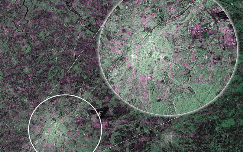
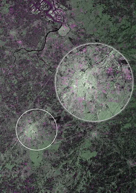
Brussels as the first image from Sentinel-1A
ESA’s Sentinel-1A, kicked off on April 3, 2014, has delivered its first RADAR images of earth. ESA’s Sentinel-1A satellite will provide the ability of policymakers and service providers to access key environmental data on a routine basis.
The mission is the first of six families of dedicated missions that will make up the core of Europe’s Copernicus environmental monitoring network. Copernicus will provide operational information on the world’s land surfaces, oceans and atmosphere to support environmental and security policymaking and the needs of individual citizens and service providers.
The first image shows Brussels in Belgium, the seat of the European commission.
This first image of Belgium was captured on 12 April, just one day after the satellite was put into its operational attitude, and demonstrates the potential of Sentinel-1A’s radar vision.
The satellite is not yet in its operational orbit, nor is it calibrated for supplying true data. This preliminary set of images simply offer a taster of what’s to come.
ESA’s Director of ESA’s Earth Observation Programmes, Volker Liebig, commented: “We are in very early days of the satellite’s life in orbit and ground segment operations, but these images certainly demonstrate the calibre of data this advanced radar mission will bring from its different imaging modes, and how it will provide essential data for Copernicus services to benefit us all.”
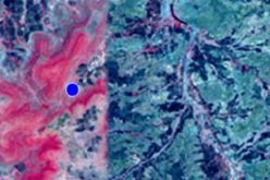
The first image, which was acquired in the satellite’s ‘strip map’ mode with a swath width of 80 km, clearly captures the dense urban environment of Brussels shown in white in the middle of the picture. Antwerp can be seen in the top left in red –blue colours and the greens depict vegetation in the surrounding areas. Waterways and low-reflective areas such as airport runways appear black.
Among other applications, images such as this will be used for urban planning, for monitoring agriculture, for mapping deforestation and for managing water resources.
This first set of acquisitions also included an area in Namibia that is currently flooded by the Zambezi river.
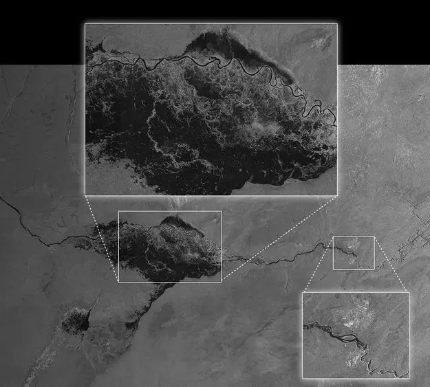
Flooding in Namibia
Sentinel-1A’s ability to ‘see’ through cloud and rain and in pitch darkness make it particularly useful for monitoring floods and for offering images for emergency response. In fact, this area of the Caprivi plain was shrouded in thick cloud when the satellite acquired the image on 13 April.
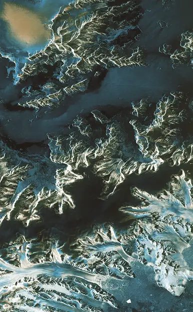
One of the images acquired on the same day focuses on Pine Island Glacier in Antarctica. This glacier is in a state of ‘irreversible retreat’ so it is important to keep a very close eye on glaciers such as these as they lose ice to the ocean.
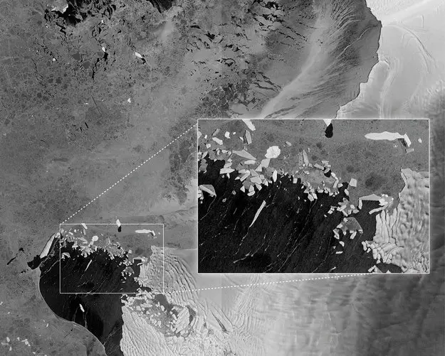
Pine Island and Thwaites Glaciers
Another shows a transect over the northern part of the Antarctica Peninsula.
Antarctica Peninsula
As well as monitoring glaciers, Sentinel-1A is poised to generate timely maps of sea-ice conditions, particularly for the increasingly busy Arctic waters. Images from its advanced radar can be used to distinguish clearly between the thinner more navigable first-year ice and the hazardous, much thicker multiyear ice to help assure safe year-round navigation in polar waters.
As these first images show, Sentinel-1A is already demonstrating the vital role it will play in the largest civil Earth observation programme ever conceived.
Source: ESA
Related Article:
- Europe Lofts First Copernicus Environmental Satellite
- SENTINEL-1A Rides into Space on a Soyuz
- EU’s first Sentinel Earth Observation satellite to launch in April


I like that.want to radar imge