Esri and FlightAware Partner for Extensive Flight Tracking and Status Data Mapping Initiative
World’s Largest Flight Tracking Company FlightAware Makes Its Data Available in Market-Leading ArcGIS Mapping Platform
Redlands, California—Esri and FlightAware have partnered to combine the power of the world’s leading flight tracking and status company with the world’s leading ArcGIS mapping platform. The partnership features the ability to view and analyze large amounts of accurate, live-aviation data in one powerful spatial system.
“Esri has the tools and expertise to visualize data in a proven GIS environment,” FlightAware business development manager Max Tribolet said. “FlightAware data is the perfect addition. We’re the largest flight tracking company in the world, based on how many disparate data feeds we have coming into our system. So it’s pretty powerful when you pull our data into GIS.”
FlightAware aggregates live flight tracking data from more than 50 government air traffic control authorities; over 10 satellite data link partners such as Garmin and ARINCDirect; and FlightAware’s own in-house ADS-B receiver network, consisting of more than 3,400 receivers in over 100 countries.
“This is a really good way to provide an additional option to our existing and potential customers, who might not have an easy way to consume larger volumes of flight tracking data,” Tribolet said. “A stand-alone app like Esri’s ArcGIS is adept at handling large quantities of data and is able to visualize it. This relationship with Esri allows FlightAware to focus on what we do best: constantly adding and aggregating quality flight tracking data and providing it to the industry.”
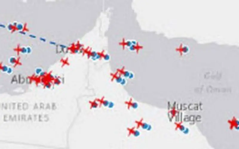
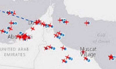
Airports and agencies have started exploring opportunities to use FlightAware data in GIS to improve proactive noise monitoring and airspace design as well as monitoring airspace congestion in real time. FlightAware visualizes live and historic data—such as altitude, longitude, latitude, ground speed, and estimated and actual schedule times—in 2D, 3D, and even 4D maps.
“The ability to fuse FlightAware data within the ArcGIS platform unlocks a host of new and innovative capabilities with regard to visualization, analysis, and collaboration,” Esri aviation business development lead Stephen Willer said. “That results in a higher level of operational intelligence. We’re excited to bring this to our users across the globe. Real-time information access like this is essential not only today but also to our future air traffic systems.”
Learn more about FlightAware at flightaware.com.
Learn more about Esri aviation technology at esri.com/airports.
# # #
About FlightAware
Founded in 2005, FlightAware was the first company to offer free flight tracking services for both private and commercial air traffic and quickly rose to become the most popular flight tracking service. FlightAware currently provides private aviation flight tracking in over 50 countries across North America, Europe, and Oceania, as well as global solutions for aircraft with ADS-B or data link (satellite/VHF) via every major provider, including ARINC Garmin, Honeywell GDC, Satcom Direct, SITA, and UVdatalink. FlightAware also continues to lead the industry in free, worldwide airline flight tracking and airport status for air travelers. FlightAware’s seamless integration of over 100 real-time, worldwide data sources combined with FlightAware’s powerful, intuitive, responsive, and reliable web-based interface yield the most capable and useful flight tracking application and service. FlightAware is privately held and has offices in Houston and New York.
FlightAware provides live flight data, airport delays, fuel prices, airline operational tools, weather maps, flight planning, flight routes, oceanic tracks, and navigation charts, as well as aviation news and photos to over ten million users a month via the FlightAware.com web site and mobile apps.
FlightAware also powers operational management and dispatch software, airport flight information displays (FIDS), airport operational tools, and third party mobile apps and provides reporting data to aircraft and airport operators.