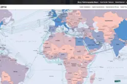
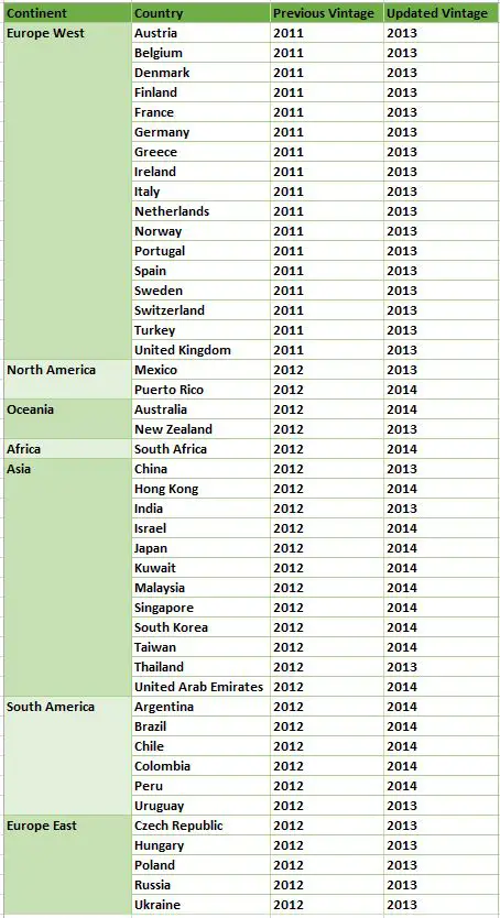
Esri has updated the Standard Global Demographic data for the 45 countries and is now available on the ArcGIS platform. The data is sourced from Michael Bauer Research, is available across the ArcGIS platform.
The Standard Global Demographic datasets differ by country but can include total population, family size, household income, median age, household type, education, consumer spending information on many types of products, and more. The data can be accessed on ArcGIS Online through web maps, data enrichment, reports, and infographics, and through Esri Business Analyst products and apps such as Esri Community Analyst, Esri Maps for Office, and ArcGIS Pro.
Source: Esri
In addition to a vintage update, there will be some additional changes made to the databases in the way of variable additions, variable deletions, changes to variable definitions, and changes to geography names. This blog is aimed to help transition to these updated global databases.
The changes that to be made to the Standard Global Demographic Data in the July Release, fully documented for all changes in a release note – July 2015 Standard Global Demographic Data Release Notes (XLS). Each country is represented in a separate worksheet within the workbook.
There are 90 international demographic web maps that will be updated to a more current vintage in July (2 web maps for each of the 45 countries included in the July 2015 release). In addition to the update in the data vintage, the Ready-to-Use Maps for Standard Global Demographic Data within ArcGIS Online will be improved with this release. Geography names will now all be presented in English.