Geospatial Energy Map of India for Effective Planning of Resources
NITI Aayog in collaboration with the Indian Space Research Organisation (ISRO) has developed a comprehensive Geographic Information System (GIS) Energy Map of India with the support of Energy Ministries of Government of India.
Geospatial Energy Map of India was launched by Dr. Rajiv Kumar (Vice Chairman, NITI Aayog), Dr. V K Saraswat (Member, NITI Aayog), and Shri Amitabh Kant (CEO, NITI Aayog) on 18 October 2021.
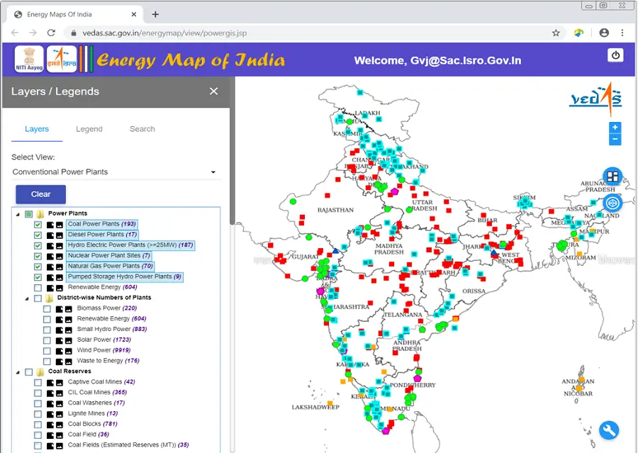
Image Source: https://vedas.sac.gov.in/energymap/
The energy data in India is fragmented and scattered across multiple departments/ministries. The energy ministries have developed maps about the sectors that they are engaged in for their own consumption such as the National Power Portal (CEA), Online Coal Block Information System (CMPDIL), India Online Exploration Database (DGH), etc. These maps are extensive in the area they cover but they are unable to provide a holistic picture of the entire energy sector. Mostly, the available maps are static (i.e. in PDF or JPG formats) as a result of which they are unable to show the associated features of the topography where critical energy attributes may be located.
Keeping the above perspective in mind, the NITI Aayog collaborated with the Indian Space Research Organisation (ISRO) and signed a Memorandum of Understanding (MoU) on June 07, 2017, to develop a comprehensive GIS-based Energy Map of India.
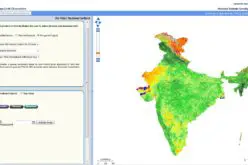
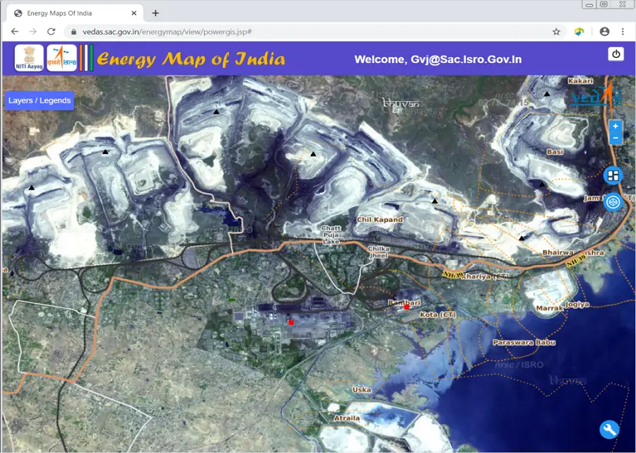
The GIS map in its current form represents a holistic picture of all energy resources. The web-based geospatial energy map of India includes visualization of spatial and non-spatial data on renewable and non-renewable power plants, oil and gas downstream sector, renewable energy potential, fossil fuel resources, and other energy assets in India.
Silent Features-
- Listing and visualization of energy resources based on energy type through 27 thematic layers –
- Conventional Power Plants
- Energy Infrastructure
- Coal
- Fossil Fuels Resources
- Hydro Electric
- Natural Gas
- Petroleum
- Biomass
- Solar
- Wind
- Petroleum Refineries
- Renewable Energy Power Plants and Renewable Energy Resources
- Facilitates to search energy resources either Zone wise or State wise
- Interactive Layer Selection
- Smooth Map Navigation
- Pre-defined Data Views
- View Map Legend and Metadata
- Overlay Maps and Images
- Measure area and distance
- Upload KML/GPX Files
- Draw Vectors on Map and Download
- Query Feature Attributes
- Fetch Production & Processing Data
- Search Power Plant
- Display State Energy Maps
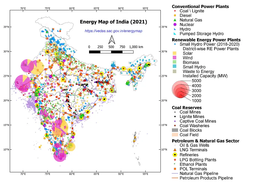
Image Source: https://vedas.sac.gov.in/energymap/
The map attempts to identify and locate all primary and secondary sources of energy and their transportation/transmission networks to provide a comprehensive view of energy production and distribution in a country. It is a unique effort aimed at integrating energy data scattered across multiple organizations and presenting it in a consolidated, visually appealing graphical manner. It leverages the latest advancements in web-GIS technology and open-source software to make it interactive and user-friendly.
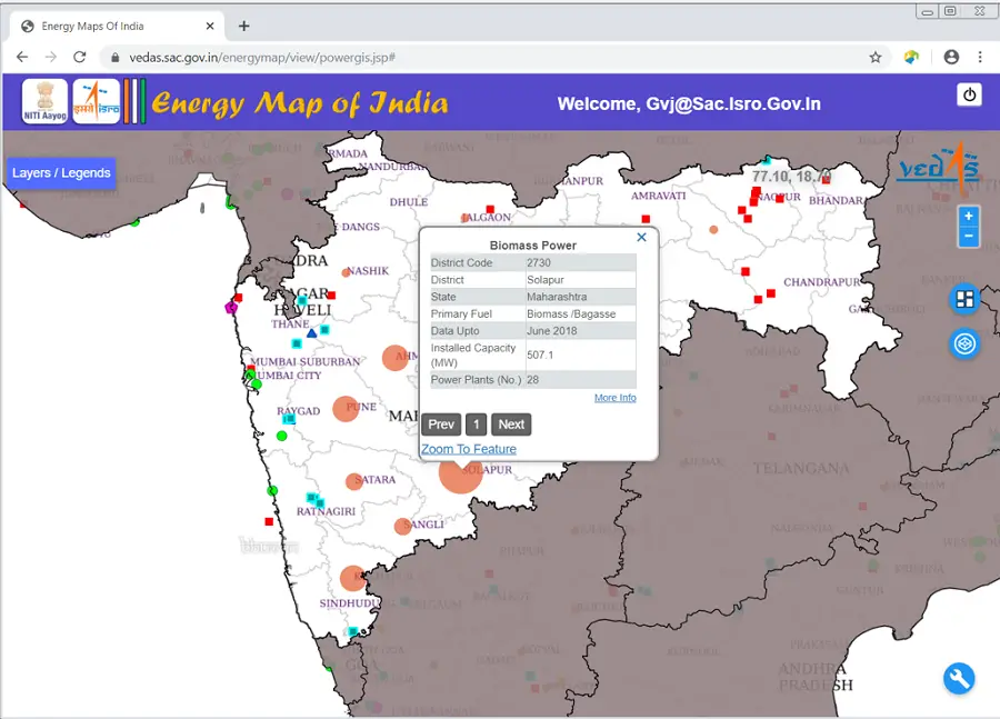
Image Source: https://vedas.sac.gov.in/energymap/
India has opened up various aspects of energy exploitation (generation/ conversion/ transmission/ consumption) to private sector. Energy markets have immense potential to bring in efficiency gains. Therefore, the GIS-based energy maps will be useful in planning and making investment decisions. It will also aid in disaster management using available energy assets.
The Energy Map of India can be accessed at– https://vedas.sac.gov.in/energymap.
Source – PIB and Energy Map of India
Also Read –
How Remote Sensing and GIS are Used to Build Check Dams Under MGNREGA?