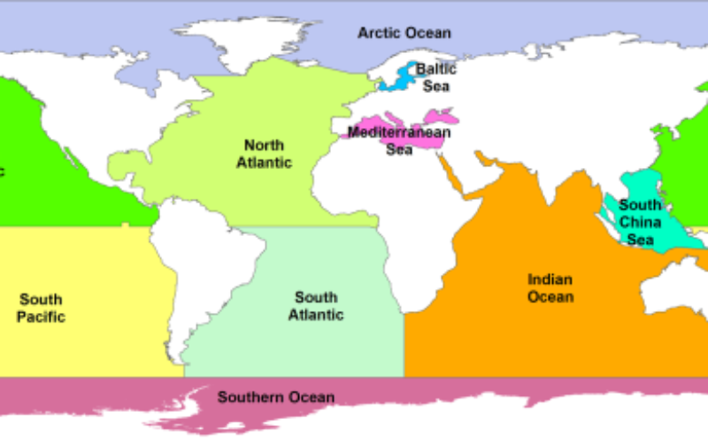
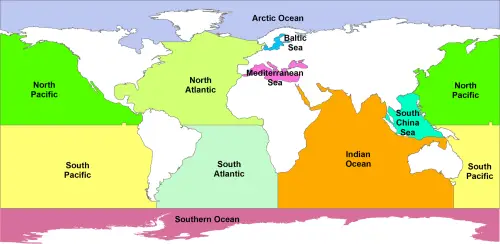
GSHHS: A Global Self-consistent, Hierarchical, High-resolution Shoreline Database – which basically means it’s good quality (no internal inconsistencies, good accuracy).
GIS Resources is an initiative of Spatial Media and Services Enterprises with the purpose that everyone can enrich their knowledge and develop competitiveness.
GIS Resources is a global platform, for latest and high-quality information source for the geospatial industry, brings you the latest insights into the developments in geospatial science and technology.