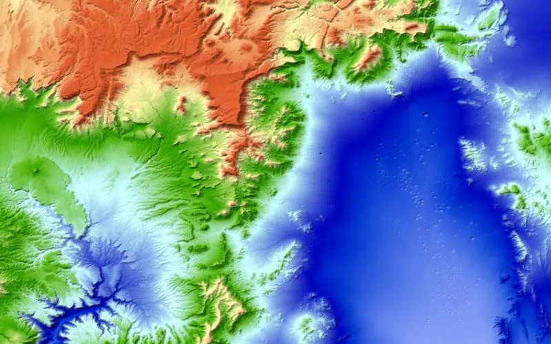
The new three-dimensional map of Earth has been completed. Mountain peaks and valley floors across the globe can now be seen with an accuracy of just one metre. The global elevation model was created as part of the TanDEM-X satellite mission; it offers unprecedented accuracy compared with other global datasets and is based on a uniform database. The approximately 150 million square kilometres of land surface were scanned from space by radar sensors. “TanDEM-X has opened up a whole new chapter in the field of remote sensing. The use of radar technology based on two satellites orbiting in close formation is still unique and was key to the high-precision remapping of Earth. In this way, DLR has demonstrated its pioneering role and satisfied the prerequisites for the next major development step in satellite-based Earth observation – the Tandem-L radar mission,” says Pascale Ehrenfreund, Chair of the Executive Board of the German Aerospace Center (Deutsches Zentrum für Luft- und Raumfahrt; DLR).

Crater landscape of the Nevada Test Site
More than 1000 scientists around the world are already making use of the data from the mission. “With completion of the global TanDEM-X elevation model, we are once again anticipating a surge in scientific interest. Accurate topographical data is essential for all geoscientific applications,” says Alberto Moreira, Principal Investigator of the TanDEM-X mission and Director of the DLR Microwaves and Radar Institute. The applications for this unique dataset range from climate and environmental research, surveying and mapping to infrastructure planning for urban development and road cnstruction.
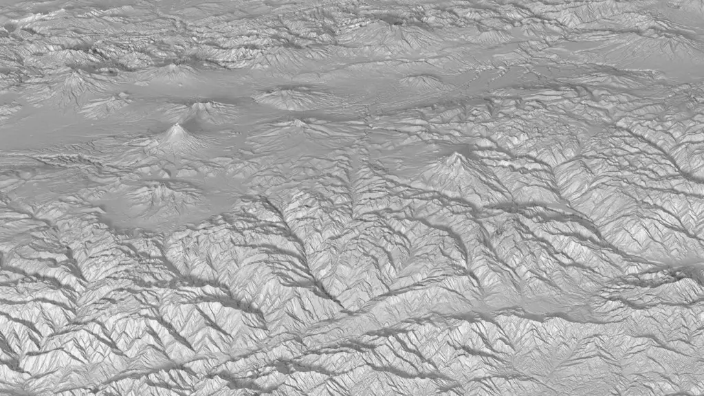
La Avenida de los Volcanes in Ecuador
Expectations exceeded
The quality of the global elevation model has surpassed all expectations. Exceeding the required 10-metre accuracy, the topographic map has an elevation accuracy of a single metre. This is a result of excellent system calibration. The distance between the two satellites in formation flight, for example, is determined with millimetre precision. The global coverage achieved by TanDEM-X is also unparalleled – all land surfaces were scanned multiple times and the data was then processed to create elevation models. In this process, DLR’s remote sensing specialists created a digital world map consisting of more than 450,000 individual models with pixel by pixel height detail – creating a special kind of three-dimensional mosaic.
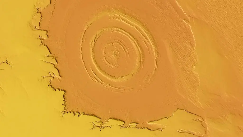
Richat Structure in Mauritania
This mission broke new ground in many areas. The close formation flight of the two satellites at a minimum distance of 120 metres has become as routine as the various manoeuvres required to continuously change the formation and adapt it to the requirements of the imaging geometry. A similar situation applies to bistatic radar operation; simultaneous data acquisition using two radar satellites was initially a major challenge, but was a necessity to ensure the high accuracy of the elevation models. DLR is now a world leader for this pioneering technology.
Between January 2010 and December 2015, the radar satellites transmitted more than 500 terabytes of data to Earth via the worldwide reception network. In parallel, systematic creation of elevation models began in 2014. Sophisticated processing chains analysed the data using highly accurate and efficient algorithms to generate the final elevation models. During this process, the data volume increased to a total of more than 2.6 petabytes and the computer systems constantly delivered top performance. “Processing this data was an exciting challenge for us,” explains Richard Bamler, Director of DLR’s Remote Sensing Technology Institute. “We are now all the more fascinated by our initial scientific findings. Using the current elevation model, we have shown that in some regions of Earth, glaciers are losing up to 30 metres in thickness per year in the area of the glacier tongues.”
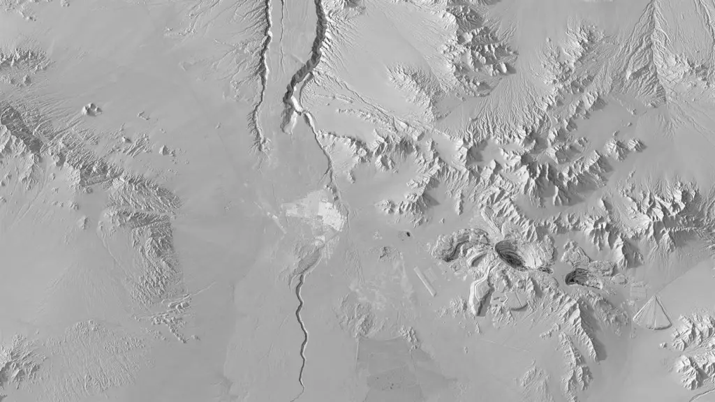
Chuqicamata copper mine in Chile
Next steps
TerraSAR-X and TanDEM-X have long exceeded their specified service lives and continue operating faultlessly and in such an efficient way that they still have enough propellant for several more years. Completion of the 3D world map does not signify the end of the mission. Due to the special nature of the formation flight, further scientific experiments are scheduled. Moreira points out: “Earth as a system is highly dynamic, which is also reflected in its topography. Through frequent updates, we could capture such dynamic processes systematically in the future. This is the primary goal of the Tandem-L mission that we have proposed.”
New Synthetic Aperture Radar (SAR) methods will enable diverse data for exploration of the global ecosystem to be provided within short periods of time. The Tandem-L successor mission could provide a current elevation image of Earth’s entire landmass every eight days and thereby capture dynamic processes in a timely manner. This would also make it possible to contribute to the review of international climate and environmental agreements. New radar methods and innovative missions such as Tandem-L are set to contribute to gaining a better understanding of dynamic processes in order to protect and preserve Earth Completion of the TanDEM-X global elevation model has now paved the way for the next dimension of radar remote sensing.
About the mission
TanDEM-X is being implemented on behalf of DLR using funds from the Federal Ministry for Economic Affairs and Energy (Bundesministerium für Wirtschaft und Energie). It is a Public Private Partnership (PPP) project operated in conjunction with Airbus Defence and Space. DLR is responsible for providing TanDEM-X data to the scientific community, mission planning and implementation, radar operation and calibration, control of the two satellites, and generation of the digital elevation model. To this end, DLR has developed the necessary ground-based facilities. The DLR Microwaves and Radar Institute, the DLR Earth Observation Center and the DLR Space Operations Facility in Oberpfaffenhofen are participating in the development and operation of the ground segment of TerraSAR-X and TanDEM-X. Scientific coordination is the responsibility of the DLR Microwaves and Radar Institute. Airbus Defence and Space built the satellites and is sharing the development and operating costs. The company is also responsible for the commercial marketing of the TanDEM-X data.