
Tag "Open Geospatial Consortium"
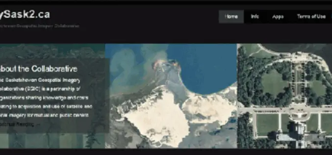
CubeWerx Signs Multi-year Contract to Provide Managed Imagery Services to SGIC
Gatineau, QC, Canada, November 13, 2018 – CubeWerx announced today it has signed a four-year contract to provide managed imagery services to the Saskatchewan Geospatial Imagery Collaborative (SGIC). CubeWerx successfully completed porting
OGC Seeks Public Comment on New Interoperable Simulation and Gaming Domain Working Group
New OGC Working Group has the goal of evaluating how standards will enable the modeling, simulation, and gaming communities to mutually benefit from ongoing technological developments. May 7, 2018 – The
OGC Seeks Public Comment on update to Abstract Specification Topic 2: Referencing By Coordinates
Third edition of this Abstract Specification describes the requirements for creating coordinate systems referencing locations in space and time. April 19, 2018 – The Open Geospatial Consortium (OGC) seeks public comment

OGC Seeks Public Comment on Web Services Security Candidate Standard
Security Standard allows the hosting of OGC Web Services (OWS) over HTTPS as well as the implementation of Information Assurance March 1, 2018 – The Open Geospatial Consortium (OGC) seeks

OGC Seeks Public Comment on Web Coverage Service (WCS) 2.1 Candidate Standard
Updated WCS 2.1 Standard will simplify access to spatio-temporal ‘big datacubes’ February 15, 2018 – The Open Geospatial Consortium (OGC) seeks public comment on the Web Coverage Service (WCS) 2.1 candidate
OGC Requesting Responses to its Portrayal Concept Development Study
This new OGC CDS is the first step in improving the way that geospatial data is visually represented in web maps February 7, 2018 – The Open Geospatial Consortium (OGC) announces
OGC Announces Disasters Interoperability Concept Development Study
Study and further initiatives aim to collate, document, and make freely available the knowledge and best practices required for geospatial data, product and information sharing in times of crisis. January
OGC Calls for Sponsors for Augmented Reality Pilot Project
Joint OGC and W3C Pilot project will propose standards to unite Augmented Reality, Web, and Geospatial technologies November 29, 2017 – The Open Geospatial Consortium (OGC), and the World Wide Web

Top 5 GIS Trends for 2018
Contributed By: You’re reading this because seamlessly integrating Geographical Information Systems (GIS) into your company’s IT infrastructure including SAP is crucial. Challenges you’re grappling with probably include absorbing tech upgrades

OGC Calls for Participation in its ‘Geospatial to the Edge’ Interoperability Plugfest
November 21, 2017 – The Open Geospatial Consortium (OGC) is calling for interested participants in its ‘Geospatial to the Edge’ Interoperability Plugfest. OGC Plugfests, initiatives of the OGC Innovation Program, provide
