OGC Seeks Public Comment on Candidate OGC® Coverage Collection Extension

 4 March 2016 – The membership of the Open Geospatial Consortium (OGC®) seeks public comment on the candidate OGC® Coverage Collection Extension Standard. The candidate OGC® Coverage Collection Extension Standard specifies a useful mechanism for grouping coverages together into a collection.
Geospatial coverages, as defined by OGC and ISO, represent homogeneous collections of values located in space/time, such as spatio-temporal sensor, image, simulation, and statistics data.
It is not uncommon for a server that implements the OGC Web Coverage Service (WCS) Interface Standard to expose many hundreds, if not thousands, of coverages. For example:
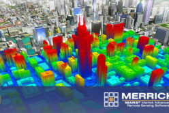
- A satellite-borne imaging device may provide many individual images, each a coverage, that may be composed into a single mosaic.
- A numerical weather prediction model may require data for many physical phenomena such as temperature, pressure and humidity. For each of these there may be a coverage for each time-step and vertical level. The number of fields in the resulting dataset can easily number in the thousands.
The candidate OGC® Coverage Collection Extension Standard specifies a useful mechanism for grouping such coverages together into a collection.
The candidate OGC® Coverage Collection Extension Standard is available for review and comment at portal.opengeospatial.org/files/67322. Comments are due by 03 April, 2016.
The OGC is an international consortium of more than 515 companies, government agencies, research organizations, and universities participating in a consensus process to develop publicly available geospatial standards. OGC Standards support interoperable solutions that “geo-enable” the Web, wireless and location-based services, and mainstream IT. OGC Standards empower technology developers to make geospatial information and services accessible and useful with any application that needs to be geospatially enabled. Visit the OGC website at http://www.opengeospatial.org.