
Tag "open source"

Ginan an Open-Source Real-Time Positioning Correction Service
As the demand for highly accurate positioning systems grows, Geoscience Australia has launched Ginan, an open-source real-time positioning correction service. Developed as part of the Positioning Australia program, Ginan offers

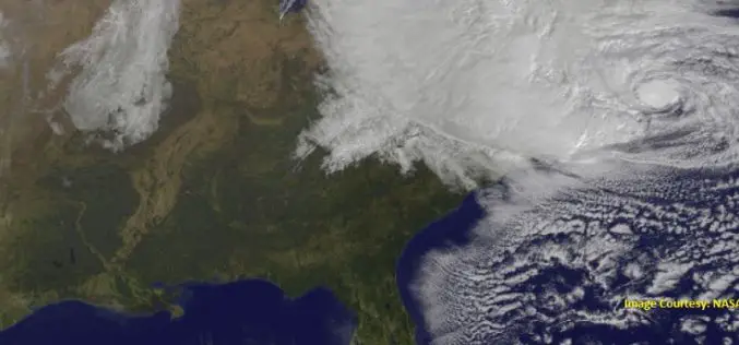
NASA ARSET Training: Monitoring Tropical Storms for Emergency Preparedness
Monitoring Tropical Storms for Emergency Preparedness Thursday, May 3, 2018 to Thursday, May 10, 2018 09:00 – 11:00 and 18:00 – 20:00 EDT (UTC-4) Tropical storms have major impacts, including loss of

Open Source Community Accelerates Big Data Analytics for Geospatial Solutions
LocationTech open source community announces new project releases that provide core technology for geospatial big data analytic solutions Ottawa, Canada – December 14, 2017 – LocationTech, an Eclipse Foundation Working Group
Storm Water Modeling and Flood Disaster Management Using Open Source Software
Contributed by: Geospatial data serves as an input in hydraulic simulation software and thereby the simulated results can further be transferred back to GIS system for real-world graphical representation of

OGC Approves Community Standard for Streaming 3D Content
September 06, 2017 – The Open Geospatial Consortium (OGC®) membership has approved a new 3D standard for content strategy. This standard is focused on high performance visualization and spatial analysis
University of Guelph: Prof. John Lindsay Develops Whitebox Geospatial Analysis Tools for Processing Geospatial Data
Professor John Lindsay has developed a one-of-a-kind software package called Whitebox Geospatial Analysis Tools for processing geospatial data that he says has put the University of Guelph on the map
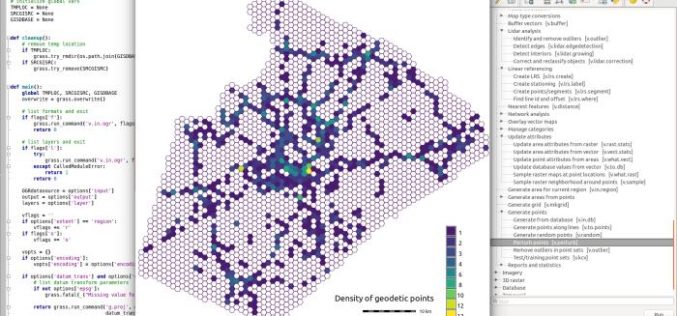
GRASS GIS 7.2.0 Released
After almost two years of development the new stable major release GRASS GIS 7.2.0 is available. It provides more than 1950 stability fixes and manual improvements compared to the former
Boundless Launches GIS Products Based on Open-Source, Data-Rich Future
Boundless is betting that open source, non-proprietary and license-free is the future of the geographic information systems (GIS) market. It’s a bet wagered in the form of dual product launches this

Course on GIS Analysis with QGIS
GIS Analysis with QGIS 6-10 February 2017 QGIS is the most popular and reliable Open Source GIS in the world. QGIS is currently used in Universities, Public Facilities and private
OGC Seeks Public Comment on Candidate OGC® Coverage Collection Extension
4 March 2016 – The membership of the Open Geospatial Consortium (OGC®) seeks public comment on the candidate OGC® Coverage Collection Extension Standard. The candidate OGC® Coverage Collection Extension Standard
