Onlinemaps Portal, SARTHI, and MANCHITRAN – Launch of 3 Online Applications to Purchase Geospatial Data Collected by Govt. Organizations
The Govt. of India in Feb 2021 announced the liberation of the Geospatial Policy of India. It has announced a new Geospatial policy to unlock new avenues for business, private sector, and research institutes to build applications and drive innovation in the creation of digital public goods.
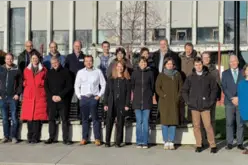
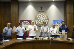
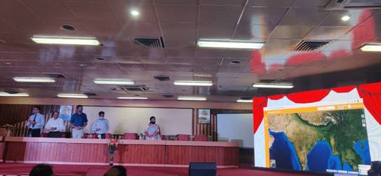
The launch of 3 online applications comes with nearly six months of new Geospatial policy. The online applications were launched on 17th August 2021 by Prof. Ashutosh Sharma, Hon’ble Secretary, Department of Science & Technology and Ministry of Earth Sciences.
The 3 online applications are –
- Onlinemaps Portal – a Geospatial data dissemination Portal by Survey of India (SOI)
- SARTHI – a Web GIS Application Portal by Survey of India (SOI)
- MANCHITRAN – an Enterprise Geoportal by National Atlas & Thematic Mapping Organisation (NATMO)
This is a historic moment because it is for the first time the data collected by the government starting from SOI and NATMO becomes freely and easily available to the citizens and organizations in India. It is truly a landmark event in the journey of SOI and NATMO, marking the spirit of true democratization of data.
Prof. Ashutosh Sharma, Secretary, Department of Science & Technology (DST), Government of India.
With the launch of this online portal, the users will no longer have to visit the SOI offices, and they can easily purchase and download products online at their doorstep through Bharat Kosh payment gateway of Govt of India.
Shri Naveen Tomar, Surveyor General of India, Survey of India (SOI)
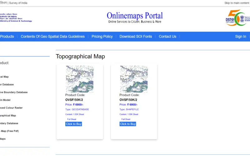
The Onlinemaps portal developed by Survey of India is a rich repository of maps and functionalities which will provide easy access and make the geo-spatial data generated out of public funds available to government and private users. The Onlinemaps portal provides a range of digital products like Digital Geographical Map, Railway Map, Political Map, Digital Geographical Road Map, Digital Geographical Physical Map of India, Open Series Map Scale, and so on to citizens of India.
Shri Naveen Tomar pointed out that Sarthi Web GIS will bring GIS into the hands of the people and save time and resources in data validation with audit trail, which will facilitate SVAMITVA (Survey of villages and mapping with improvised technology in village areas), a new initiative of the Ministry of Panchayati Raj.
Sarthi is a web Geographical Information System GIS application that utilizes the new advancements in web application development with GIS tools like spatial data visualization, manipulation, analysis, etc., and will be easily accessible to the user with less utilization of resources at the client’s end. It reduces the need to create custom applications and provides a platform for integrating GIS with other business systems. It enables cross-organizational collaboration in consonance with the new Geospatial Policy and can be accessed in vernacular languages.
Speaking about MANCHITRAN, Dr. Tapati Banerjee, Director NATMO, said that the enterprise geo-portal of NATMO is a giant leap forward in the arena of geo-spatial data sources, and the setting of infrastructure along with the applications was initiated in the year 2017, and finally it has come to online in the year 2021. It will open a new dimension of extended services for the citizens of India, and different building blocks of the “MANCHITRAN” will serve the requirements of students, researchers, industry, decision-makers, policymakers, administrators, etc.
This geo-portal showcases the huge, authenticated, and valuable data that NATMO acquired during its long 65 years’ service. Users can see, download and give feedback about the maps and atlases and different geo-spatial data layers in “MANCHITRAN.” NATMO has developed this geoportal mostly with indigenous Make-in-India technologies and with minimum financial involvement and time period.
Click to access Onlinemaps Portal by Survey of India (SOI)
Click to access Geoportal by NATMO
Source – PIB
Also Read –
Survey of India Launches Web Portal to Download Maps