
Tag "UNESCO"

Brinda Kashyap Earns UNESCO MAB Young Scientist Award for Rhino Protection
In a significant achievement for India, Brinda Kashyap, a young scientist from Guwahati, Assam, has been honored with the prestigious UNESCO MAB (Man and Biosphere) Young Scientist Award. This award

Copernicus Satellite Data for Cultural Heritage Monitoring and Preservation
The free and open data and information delivered by the Copernicus programme represents a valuable resource for Cultural Heritage monitoring and preservation at European and global level. The data and
DLR Spin-off EOMAP Launches an Online Portal for UNESCO Programme on Global Indicator of Water Quality
Worldwide mapping of water quality data for all inland and coastal waters is now possible for the first time thanks to satellite data. Using high-resolution remote sensing data, EOMAP has

Two UN Agencies Adopted Geospatial Technologies to Protect Cultural Heritage
Two United Nations agencies (UNOSAT and UNITAR) have signed an agreement to protect cultural and natural heritage sites by using the latest geospatial technologies, including a satellite imaging system. The
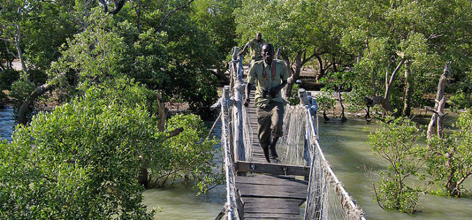
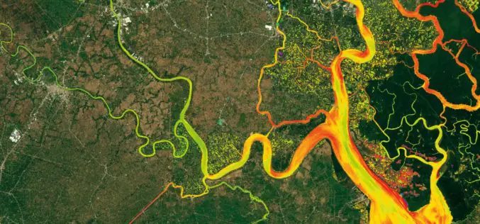
Bluesky Sponsors UNESCO Biosphere Reserve Expansion in Kenya
Leicestershire, 16 February 2016 – Aerial mapping company Bluesky is aiding the expansion of a UNESCO Biosphere Reserve in Kenya. Working with Cranfield University, the UK-based aerial survey specialist will provide

Eyes in the Sky to Protect World Heritage Angkor Wat
As reported in Xinhua, China signed a MoU with HIST (UNESCO) to use remote sensing technology to provide a new level of protection for the ruins of Cambodia’s Angkor Wat, the
UNESCO and UNITAR-UNOSAT Signed an Agreement to Protect Heritage Using Geospatial Technologies
UNESCO and UNITAR (the UN Institute for Training and Research) have signed an agreement to protect cultural and natural heritage sites with the latest geospatial technologies. It was signed at
INCOIS: International Training Course On”Ocean Colour Remote Sensing – Data, Processing and Applications”
International Training Course On “Ocean Colour Remote Sensing – Data, Processing and Applications” Organized by International Training Centre for Operational Oceanography (ITCOcean) ESSO-INCOIS, Hyderabad, India November 10-14, 2014 Indian National Center for Ocean Information Service (INCOIS) under earth System Science organization (ESSO) is a dedicated institution for operational oceanography and the
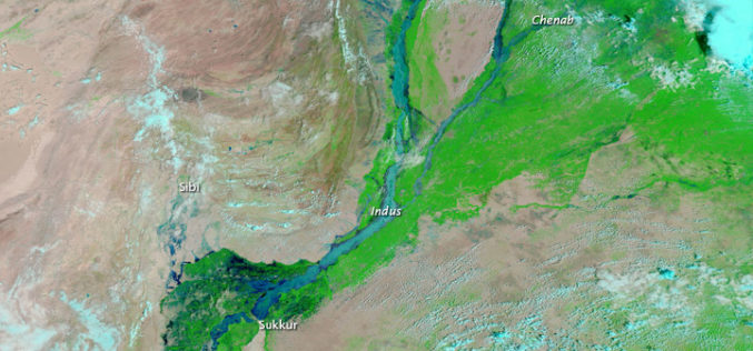
Pakistan to Adopt Remote Sensing and GIS Based Flood Mitigation System
In recent news by The Express Tribune, Pakistan Space and Upper Atmosphere Research Commission (SUPARCO) in collaboration with UNESCO will install satellite remote sensing and GIS technologies across Pakistan for
