
Tag "3D visualization"
Golden Software Enhances Surfer® Mapping and 3D Visualization Package with Map Templates and Online Image Access
Golden Software has added significant time-saving features to the latest version of its Surfer mapping and 3D visualization software. Users can now choose from more than 20 frame templates to

Aspectum Releases A Smart Map of Besiktas Shipyard for Better Maritime Business Management
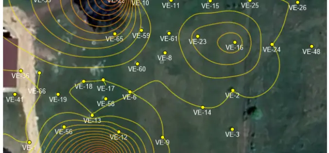
Aspectum, a cloud service for location data analytics, presents its latest interactive map of Besiktas Shipyard. This map serves as an example of shipyard management. Just in a few clicks,

SPAR 3D Expo & Conference – International Event for Commercial 3D Sensing, 3D Processing, and 3D Visualization Tools
SPAR 3D Expo & Conference, presented by SPAR 3D.com and co-located with AEC Next, is an international event for the commercial application of 3D technologies from input to output. For
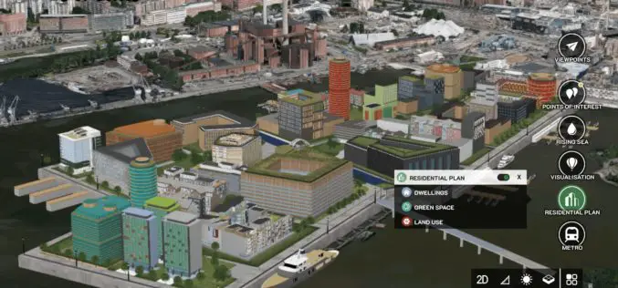
Bentley Acquires Agency9 to Realize Digital Twins for Every City
OpenCities Planner takes advantage of city-scale reality modeling to span GIS and BIM LONDON, U.K. – The Year in Infrastructure 2018 Conference – 15 October 2018 – Bentley Systems Incorporated, the leading global provider of comprehensive software solutions for

PDF3D Work With Forensics to Bring 3D PDF into the Court Room
3D PDF conversion software leaders, PDF3D, have today released a new eBook that will help forensic investigators and engineers improve presentation of evidence and 3D reconstructions in court. London, October
Evolving Photogrammetry from Single-Pair Stereo to Multi-View rayCloud
Pix4Dmapper Pro’s rayCloud is a full-3D interface which allows visualization and analysis based on multi-ray intersections from 2D images. This provides a more accurate and consistent solution than extracting 3D

Vricon Announces Reseller Agreement with Esri
McLean, VA — March 3, 2017 — Vricon, a leading provider of highly accurate photorealistic 3D products and elevation data of the earth, today announced it has signed a reseller agreement with
Vricon Launches Newest, Disruptive Geospatial Product: Digital Terrain Model
McLean, VA – Vricon unveils the newest product in the Vricon Data Suite: the 0.5m resolution Digital Terrain Model (DTM), a high-resolution bare earth elevation data layer. Vricon produces its
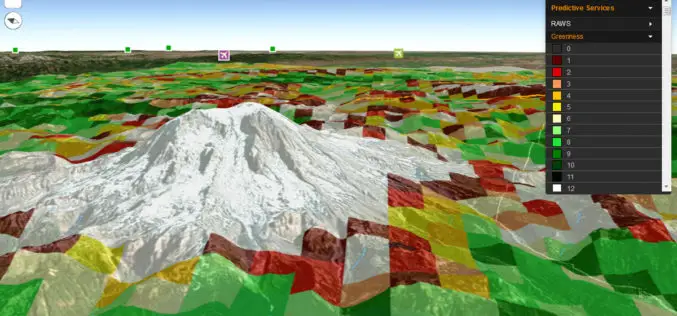
Fire Globe Delivers Esri 3D Visualization to US Firefighters
The National Interagency Fire Center Migrates to the Esri Platform and Improves Situational Awareness Redlands, California—The National Interagency Fire Center (NIFC) has transferred its web GIS application, Fire Globe, to
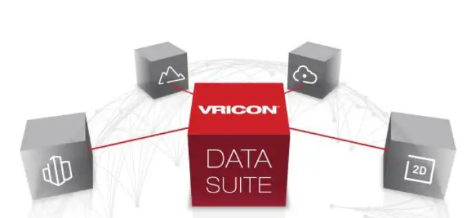
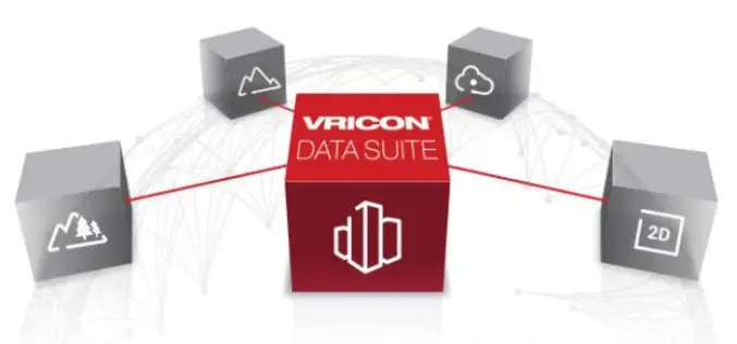
Vricon Data Suite: Putting Earth in Customers’ Hands
7 January 2016 — Today, Vricon unveils its Data Suite that includes the Vricon 3D Surface Model, Vricon DSM, Vricon Point Cloud, and Vricon True Ortho. All four products are
