
Tag "Airborne laser scanning"
RIEGL Presents New Products at INTERGEO 2021
INTERGEO is back LIVE in Hanover this year – and RIEGL presents the latest developments in hardware and software at booth 20C.22 in hall 20 but also digital at the
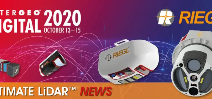
INTERGEO 2020 DIGITAL, October 13-15, 2020: RIEGL Presents Their New Products 2020
2020 is a very special year – COVID-19 has taught us to think in new dimensions and to work in new spheres. Nevertheless, RIEGL does not want to break with
RIEGL with Broad and Impressive Product Range, New Products at Intergeo 2016
RIEGL uses the INTERGEO platform traditionally to give an insight and an overview on its comprehensive LiDAR sensors and systems product range. At booth C3.059 in hall A3, on the

Geospatial Research Program Seeks Project Applications
FAYETTEVILLE, Ark. – The Spatial Archaeometry Research Collaborations (SPARC) Program, a National Science Foundation-funded initiative at the Center for Advanced Spatial Technologies at the University of Arkansas, is accepting applications
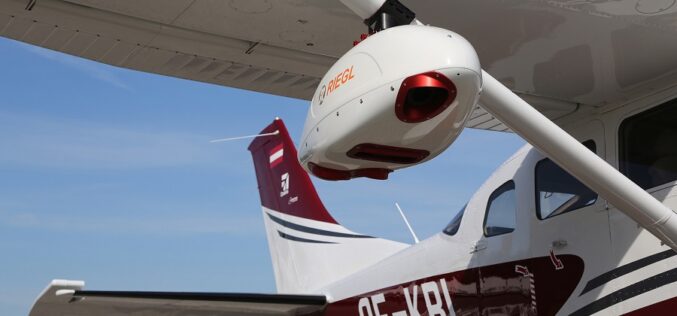
RIEGL with Impressive Display at INTERGEO 2015 in Stuttgart
On the first day of INTERGEO RIEGL delivered an impressive display in Stuttgart! With a special UAV-area at booth E4.079, live demo UAV-flights at the outdoor area, and the unveiling

Vienna University of Technology Releases OPALS v 2.1.5 – A Airborne Laser Data Processing Software
The Department of Geodesy and Geoinformation, Vienna University of Technology announces the release of OPALS version 2.1.5. OPALS stands for Orientation and Processing of Airborne Laser Scanning data. It is a
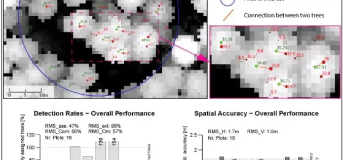
A Benchmark of Lidar-Based Single Tree Detection Methods Using Heterogeneous Forest Data from the Alpine Space
A Benchmark of Lidar-Based Single Tree Detection Methods Using Heterogeneous Forest Data from the Alpine Space – Lothar Eysn, Markus Hollaus, Eva Lindberg, Frédéric Berger, Jean-Matthieu Monnet, Michele Dalponte, Milan Kobal, Marco Pellegrini, Emanuele
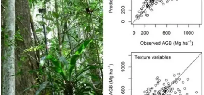
Modeling Aboveground Biomass in Dense Tropical Submontane Rainforest Using Airborne Laser Scanner Data
Modeling Aboveground Biomass in Dense Tropical Submontane Rainforest Using Airborne Laser Scanner Data – Endre Hofstad Hansen, Terje Gobakken, Ole Martin Bollandsås, Eliakimu Zahabu and Erik Næsset Abstract: Successful implementation of projects
