
Tag "ArcGIS Online"
Esri Helps Youth Locate First Job
Labor Force Initiative Calls for Greater Opportunities for Young People Redlands, California—Advocates of the Opportunity Youth Network (OYN) have called for employers nationwide to embrace young people entering the workforce

DigitalGlobe and Esri Announce New Long-Term Partnership to Expand World Imagery Map
WESTMINSTER, Colo.–(BUSINESS WIRE)–Jun. 27, 2016– DigitalGlobe, Inc. (NYSE: DGI), the global leader in earth imagery and information about our changing planet, today announced an agreement to make more current satellite
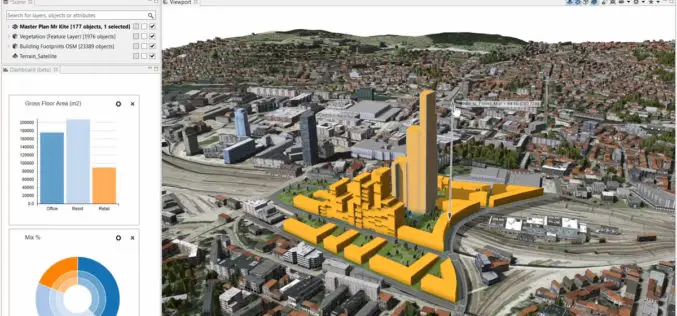
Build Smart 3D Cities in Minutes with Game-Changing Esri CityEngine 2016
Redlands, California—Esri, the global leader in geographic information system (GIS) solutions, today announced the release of Esri CityEngine 2016. This revolutionary modeling technology allows GIS professionals, 3D artists, architects, and

What’s New in ArcGIS Online June Release
The June update of ArcGIS Online features improvements to item pages, updated content, and more options for administrators. Improved Item Pages Check out the redesign. It includes better work flows,

Esri and Hexagon Promote Their Joint Collaboration at HxGN LIVE
Redlands, California—June 14, 2016—In 2015, Esri and Hexagon jointly announced a series of ready-to-use imagery services to Esri users through the ArcGIS Market Place. The ArcGIS Market Place delivers high-resolution

Esri India Webinar: What’s new in ArcGIS 10.4 Desktop?
Esri India Webinar: What’s new in ArcGIS 10.4 Desktop? 2nd June 2016, 11:00 AM IST onwards ArcGIS 10.4, the latest release, includes exciting new capabilities for visualizing and analyzing data.

Esri Webinar: Drone2Map for Engineering and Construction
Drone2Map for Engineering and Construction Tue, Apr 26, 2016 11:30 PM – Wed, Apr 27, 2016 12:30 AM IST Unmanned aerial systems enable engineers to better understand the terrain they

Esri Publishes the Workbook Getting to Know ArcGIS Pro
Learn to Use Esri’s ArcGIS Pro and Start Making Informative 2D and 3D Web Maps The new workbook Getting to Know ArcGIS Pro teaches the fundamentals of making 2D and
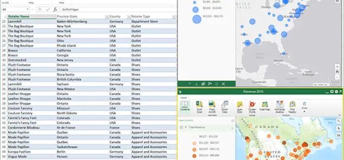
ArcGIS Maps for Office to Brings Mapping Capabilities into Microsoft Excel and Microsoft PowerPoint
ArcGIS Maps for Office, part of the ArcGIS platform, is an add-in for Microsoft Office that brings mapping capabilities into Microsoft Excel and Microsoft PowerPoint. With ArcGIS Maps for Office,

Atlas for a Changing Planet Story Map Delivers Cause and Effects of Climate Change
Esri’s Atlas for a Changing Planet Story Map Delivers Geographic Insight for Sustainable Planning and Development Redlands, California—Esri, the world leader in geographic information system technology, released an interactive map
