
Tag "basemap"

Insights to SuperGIS Server 10
Supergeo is going to upgrade all the products to a new level, the 10 series, including SuperGIS Server. The most exciting thing in SuperGIS Server 10 is its integration of
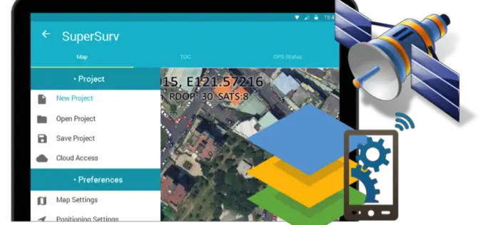
Behold! SuperSurv 10 Come for Unleashing the Power of Latest Technology in Mobile GIS
Can’t find the best fit mobile GIS solution for your field work? Wondering with all the hardcore and complicated operations in most survey Apps? Get ready to experience the brand

TerraGo Webinar: CAD Data in the Palm of Your Hand
CAD Data in the Palm of Your Hand June 23, 2015 12:00 – 12:30 PM ET Join this webinar to learn how to put CAD drawings in the hands of

DigitalGlobe Produces the World’s First Complete and Consistent High Resolution Satellite Imagery Base Map of Africa
LONDON–(BUSINESS WIRE)–Apr. 28, 2015– DigitalGlobe, Inc. (NYSE: DGI), a leading global provider of high-resolution earth imagery and geospatial solutions, today announced the general availability of its Basemap +Vivid product for
Discover Top 10 GIS Features with Latest SuperGIS Desktop
To make GIS software friendlier and easier to access, Supergeo, the leading GIS software provider, collects GIS users’ ideas around the world, and votes the 10 most useful features of
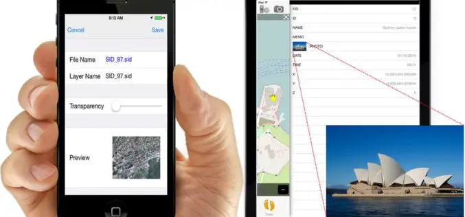
iOS Mapping Solution, SuperSurv, Enhances Raster Data Support
Supergeo releases the latest update of SuperSurv 3.2 (iOS) to enhance the functionality and efficiency for mobile GIS surveyors. Having stronger compatibility with raster dataset and convenient tools for data
