TerraGo Webinar: CAD Data in the Palm of Your Hand

TerraGo Webinar: CAD Data in the Palm of Your Hand

CAD Data in the Palm of Your Hand

June 23, 2015
12:00 – 12:30 PM ET

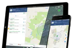
Join this webinar to learn how to put CAD drawings in the hands of mobile users with TerraGo Edge.

Using a modern, mobile GPS data collection and collaboration solution, your field workers can utilize CAD drawings as basemaps for inspections and field based verifications. Any level of precision can be met by utilizing a Bluetooth enabled GPS. Data collected within TerraGo Edge can be roundtripped back to the CAD or GIS system of record faster than ever.

Register Now

Categories: Webinars

About Author

GIS Resources

GIS Resources is an initiative of Spatial Media and Services Enterprises with the purpose that everyone can enrich their knowledge and develop competitiveness. GIS Resources is a global platform, for latest and high-quality information source for the geospatial industry, brings you the latest insights into the developments in geospatial science and technology.

Write a Comment

Your e-mail address will not be published.
Required fields are marked*

This site uses Akismet to reduce spam. Learn how your comment data is processed.