
Tag "disasters"
OGC Invites You To The Disasters CDS Workshop at NASA Ames
Workshop will shape future activities to be led by OGC regarding disaster preparedness & response, and to inform potential Disaster Spatial Data Infrastructures (SDI). April 18, 2018 – The Open Geospatial

OGC Announces Disasters Interoperability Concept Development Study
Study and further initiatives aim to collate, document, and make freely available the knowledge and best practices required for geospatial data, product and information sharing in times of crisis. January
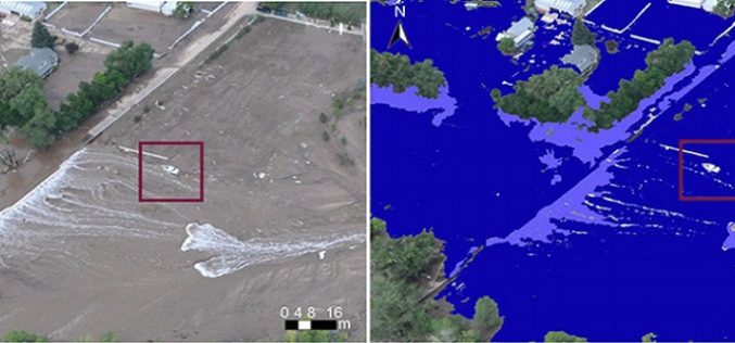
Mining Social Media to Task Satellite Data Collection During Emergencies
Combining satellite imagery with social media data enables a good match between predictions and observations in emergency situations. The era of Internet and social media has drastically changed the way

2nd Call for Expression of Interest ‘Quantifying Risk and Recovery of Disasters’
The European Commission has launched the second call for expression of interest for a limited number of risk and recovery activations through its Copernicus Emergency Management Service for Risk &

UN Office Report Shows Opportunities for Remote Sensing in Humanitarian Assistance
The Policy Analysis and Innovation Section of the UN Office for Coordination of Humanitarian Affairs (OCHA) released the World Humanitarian data and Trends 2014 report, dealing with humanitarian
