
Tag "ESRi"
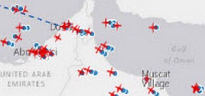
Esri and FlightAware Partner for Extensive Flight Tracking and Status Data Mapping Initiative
World’s Largest Flight Tracking Company FlightAware Makes Its Data Available in Market-Leading ArcGIS Mapping Platform Redlands, California—Esri and FlightAware have partnered to combine the power of the world’s leading flight
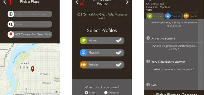
Mobile App Puts Power of Place in People’s Hands
New Featured Maps Deliver Insights into Mankind’s Relationship with the World Redlands, California—Smartphone users now have access to Field Notes—Earth, a new mobile app from Esri that employs the power
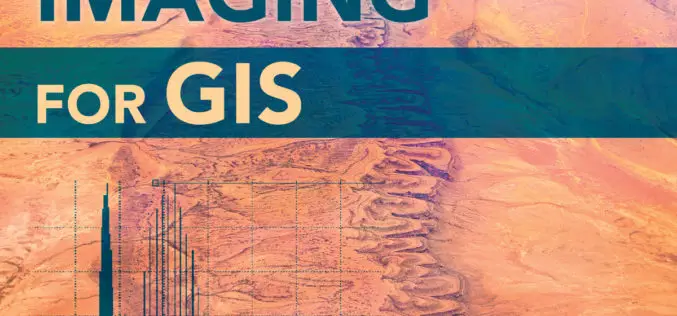
Earth Imaging Gets a Close-Up
New Esri Book Covers Basics of Collecting, Enhancing, and Interpreting Aerial Images within a GIS Satellites, aircraft, and unmanned aerial systems (UAS) collect imagery that can be displayed and analyzed

Esri Webinar: Create and Share ArcGIS Pro Tasks
ArcGIS Pro tasks are preconfigured steps that interactively guide a user through a specific workflow. Tasks make it easy for users of all GIS experience levels to complete standard workflows—from
ImageConnect to Add High Resolution Imagery by DigitalGlobe into ArcGIS Desktop Environment
DigitalGlobe in partnership with Esri has come up with a plug-in “ImageConnect” to enhance the GIS experience of ArcGIS platform user. ArcGIS users can download the plugin from ArcGIS Online

The ArcGIS Book: 10 Big Ideas about Applying Geography to Your World
Learn to Make GIS Web Maps, Work with Mobile Apps, and Do More, Using The ArcGIS Book from Esri People around the world are discovering that online maps do more

EagleView Announces Gold Status within Esri Partner Network
EagleView Technology Corporation, a leading technology provider of aerial imagery, data analytics and GIS solutions, announced that its wholly owned subsidiary, Pictometry International Corp., has obtained gold status within the

City of Oakland’s Real-Time Crime Map Advances Transparency
Oakland Police Department Aims to Drive Citizen Engagement with Open Data Redlands, California—The City of Oakland, California, has taken another step toward offering citizens open access to public data by
Esri and NT Concepts Help Transition Google Earth Enterprise Customers
Meeting the Requirements of the Intelligence Community a Top Priority Redlands, California—In coordination with Google, Esri is providing replacement software and training to customers and partners using Google’s enterprise geospatial
Esri Joins International Partnership to Enhance Climate Resilience in Developing Countries
Colombia, Ethiopia, and Bangladesh to Harness ArcGIS Platform to Achieve Long-Term Sustainability Redlands, California—In a next phase of support of The White House Climate Action Plan, Esri will donate its best-of-breed
