
Tag "Geographic Information System"

Maps.com Launches “Field Trip Library” for K–12 Students
Interactive Exercises Based on the Esri Story Map Platform Redlands, California— (GIS) concepts while exploring global culture, regional patterns, and major historical events through interactive maps. Field trips are enhanced with
Esri and European Schoolnet Partner to Deliver Geographic Education Internationally
More Than 30 Ministries of Education to Gain Access to ArcGIS Online Redlands, California—School systems across Europe will soon have access to the world’s leading online mapping software for delivering

CoreLogic Releases New Natural Catastrophe Risk Models
––EQECAT RQE v15.0 Platform Includes New Windstorm, Earthquake and Tsunami Risk Models –– CoreLogic® (NYSE: CLGX), a leading global property information, analytics and data-enabled services provider, today released a new

Uttar Pradesh Police to use GIS for Quick Response on Emergencies
In recent news, Uttar Pradesh Police will be using GIS technology to improve the efficiency of emergency emergency response and security surveillance system, in the cities of Allahabad and Ghaziabad,

GIS Technology to Build 100 Smart Cities
According to recent news, M Venkaiah Naidu, the new Union Minister for Urban Development and Housing and Poverty Alleviation said that building 100 smart cities in country is the top most priority of

GIS To Prepare Tribal Map of India: Orman
In recent news, Union Tribal Affairs Minister Jual Oram said his ministry is planning to information technology to closely monitor various tribal welfare plans and projects for development of tribal areas.

GIS to Add Traffic Intelligence in Abu Dhabi
In recent news, Abu Dhabi is using a unique intelligence system “Intelligent Safety Management System” which uses Geographical Information System to create solutions for certain problems such as speeding and

Selection of Consultant for Geographic Information System(GIS) Mapping and Survey for Village Abadi in Noida
New Okhla Industrial Development Authority (hereinafter referred to as “NOIDA” or “the Authority”) intends to hire consultancy services for Geographic Information System Mapping and Survey of the abadi villages in Noida.
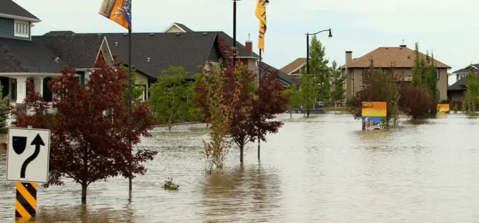
Fighting floods with GIS -based emergency response system
The New South Wales State Emergency Services (NSW) will have a new weapon this flood season after rolling out a high-tech mapping system that allows volunteers on the ground to

How GIS Revolutionizing Defense Strategy and Intelligence Operations
Most national security decisions involve geography. Whether assessing potential terrorist targets, planning where to strike on the battlefield, or deciding where to locate a new building with minimal environmental impact,
