
Tag "Geological Survey"
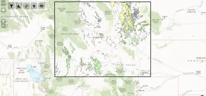
WSGS Completes First Update to Online Oil and Gas Map since its Launch in July
The Wyoming State Geological Survey (WSGS) has completed the first update to its online Oil and Gas Map of Wyoming, including revising the map’s data and improving its functionality. The

BLM, USGS Publish Data and Visualization Site for Sagebrush Geospatial Data
The Bureau of Land Management and the U.S. Geological Survey have published a hub to enable easy visualization and access to geospatial data about the west’s “sagebrush sea.” This will help
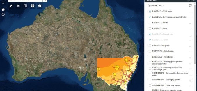
New South Wales Government Launches Renewable Energy Resources Map
In a recent news release by the New South Wales Government, in a state first, NSW will have a renewal energy map to help drive investment in new renewable projects across

President’s 2017 Budget Proposes $1.2 Billion for the USGS
Reflects the ongoing commitment to scientific discovery and innovation to support decision making for critical societal needs WASHINGTON—The President’s fiscal year (FY) 2017 budget request for the U.S. Geological Survey

New State Map from Indiana Geological Survey Makes Use of High-Res Imaging
BLOOMINGTON, Ind. — The Indiana Geological Survey has published a new state map that features the latest digital technology using high-resolution elevation data. The map was prepared using lidar data
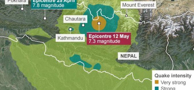
Geological Survey of India Mapping Nepal Earthquake Aftershocks
In a bid to aid community preparedness, scientists at the Geological Survey of India (GSI) are monitoring the aftershocks in various parts of the country following the massive April 25
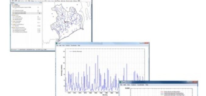
U.S. Geological Survey Groundwater Toolbox, a Graphical and Mapping Interface for Analysis of Hydrologic Data
U.S. Geological Survey groundwater toolbox, a graphical and mapping interface for analysis of hydrologic data (version 1.0): user guide for estimation of base flow, runoff, and groundwater recharge from streamflow
