New State Map from Indiana Geological Survey Makes Use of High-Res Imaging
BLOOMINGTON, Ind. — The Indiana Geological Survey has published a new state map that features the latest digital technology using high-resolution elevation data. The map was prepared using lidar data — light detection and ranging — collected by specially equipped aircraft flying over the entire state.
The lidar data were acquired over a three-year period beginning in 2011 and, following a rigorous process of quality control to ensure their accuracy, the digital data were made available to geographic information system technologists in January 2014.
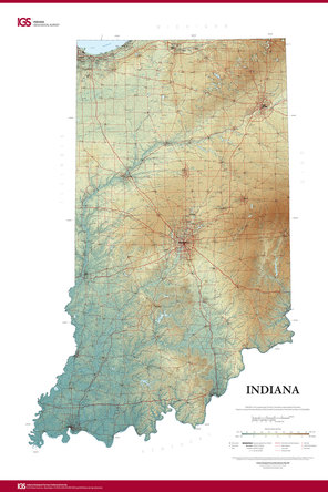
“Maps must be accurate to be useful, but they can also be beautiful,” said Matt Johnson, Indiana Geological Survey head cartographer, who is one of the compilers of the new map.
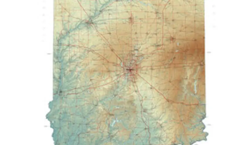
The shaded-relief map, titled “Indiana,” is printed in full color on high-quality poster paper and measures 28 by 42 inches. It is a 1:500,000-scale map (1 inch on the map equals 7.89 miles) that provides a highly detailed depiction of the diverse landscapes of Indiana.
Included are highways and roads; lakes, rivers and streams; county seats; and population data. Elevations are represented by color, and this, in combination with relief-shading techniques, gives the map a three-dimensional look.
From across the room, one can easily see the incised landscape of the Wabash Valley or, in the northeastern part of the state, the subtle moraines left by retreating glaciers of the Ice Age. Closer up, in the southern part of the state, the details of the uplands and river bottoms become readily apparent.
“Indiana is one of only eight states nationwide that has complete lidar coverage, and it is the only state that has made this information accessible to the public in this format,” said Indiana State Geologist John Steinmetz. “This map contains information to support decision-making where topographic features are of critical importance. It will also facilitate conversations among legislators and stakeholders regarding the importance of timely and high-quality data acquisition.”
The map is available from the Indiana Geological Survey Bookstore on the Web. The cost is $10 plus tax and shipping; the map is sent rolled in a tube. You can also order by phone at 812-855-7636 or by email IGSinfo@indiana.edu.
The Indiana Geological Survey is a research institute of Indiana University that receives support, in part, from the Office of the Vice Provost for Research at IU Bloomington; its mission is to provide geologic information and counsel that contribute to the wise stewardship of the energy, mineral and water resources of the state. Established in 1837, it provides focused research initiatives and cooperative investigations with governmental agencies, businesses and industries, and educational organizations; geologic sample and data collection and archiving; and dissemination of information in many forms, including published maps, reports, databases and educational outreach programs.