
Tag "geospatial"

OGC is Calling for Sponsors for an Innovative Interoperability Initiative, Testbed 14
Thursday, 27 July 2017 – The Open Geospatial Consortium (OGC®) has issued a call for sponsors for an innovative interoperability initiative, Testbed 14. The OGC Innovation Program provides a venue

Esri Story Map: Unusual Indian Weddings that Challenged Stereotypes
Contributed By:- Here are the wedding stories of young couples and their families who dared to fight stigmas and break stereotypes. These stories rekindle faith in humanity and leave you
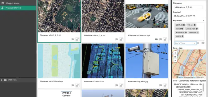
LizardTech and Extensis Optimize Digital Asset Management for Geospatial Data
LizardTech and Extensis Optimize Digital Asset Management for Geospatial Data Latest Version of Extensis Portfolio Extends DAM to Geospatial Industry; Solution Indexes, Catalogs, Shares MrSID Files Portland, Ore.— July 19, 2017 — LizardTech®

TBC Webinar: TBC Power Hour – Defining and Working with Grid and Ground Coordinates
TBC Power Hour – Defining and Working with Grid and Ground Coordinates JULY 26, 2017 | 08am MT / 4pm MT Grid Coordinates. Ground Coordinates. Two fundamental concepts for surveyors

Trimble and Komatsu Collaborate to Improve Interoperability for Mixed Fleet Earthworks Customers
SUNNYVALE, Calif., July 14, 2017—Trimble (NASDAQ:TRMB) and Komatsu Ltd. announced today that they are collaborating to improve their customers’ ability to exchange 3D construction site data between Komatsu and Trimble
USGIF Universal GEOINT Certification Program
USGIF has launched a first-of-its-kind, transparent, and transportable Universal GEOINT Certification Program and professional designation that proves your deep and balanced understanding of the GEOINT tradecraft. The goal of the Universal GEOINT Certification Program is to provide
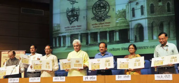
Survey of India Strives to Keep India Among the Best Surveyed Countries in the World-Manoj Sinha
Survey of India Strives to Keep India Among the Best Surveyed Countries in the World-Manoj Sinha Commemorative postage stamp released on 250th anniversary of Survey of India Minister of Communications
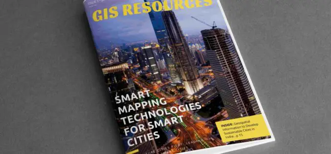
2nd Edition of GIS Resources Magazine: Smart Mapping Technologies for Smart Cities – Download it Now!
Thanks for your interest and downloading GIS Resources second edition. Subscribe our mailing list to keep updated of developments in the Geospatial domain. Click to Download Second Edition – Smart
Facebook Launches Disaster Maps to Help Communities Recover and Rebuild
According to recent news by the Facebook Newsroom, Facebook is introducing disaster maps that use aggregated, de-identified Facebook data to help organizations address the critical gap in the information they often
Harris Corporation Provides Industry Training to National Geospatial-Intelligence Agency Employees
Highlights: Participants learn Harris workflows, innovative technologies, and commercial processes Best practices delivered via Harris Geospatial Innovation Center Program part of long Harris-NGA collaboration on geospatial technology solutions June 7,
