
Tag "geospatial"
World’s Largest Satellite Fleet Owner Joins The Geological Remote Sensing Group
The Geological Remote Sensing Group (GRSG) has expanded its membership once again with the recent news that Planet; the owners and operators of the world’s largest commercially-operated fleet of satellites
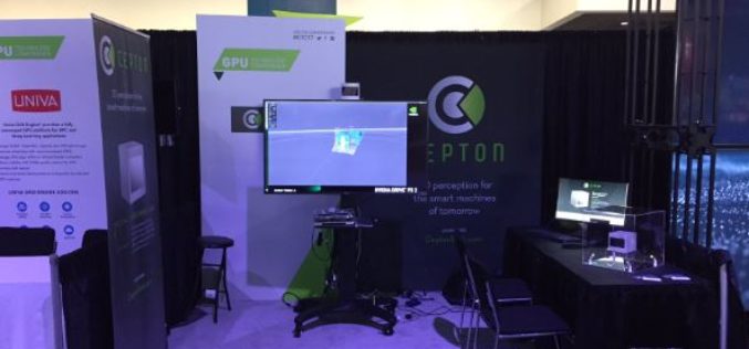
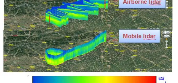
Cepton Launches its High-Performance LiDAR Solutions
Next-generation optical sensors deliver perception to smart machines with unrivaled resolution and cost May 09, 2017 – SAN JOSE, Calif.–(BUSINESS WIRE)–Cepton Technologies, Inc., a provider of 3D sensing solutions for automotive

OGC invites you to its Environmental Linked Feature Interoperability Experiment: ELFIE
Monday, 8 May 2017 UTC – The Open Geospatial Consortium (OGC®) invites interested members & non-members alike to participate in the OGC Environmental Linked Feature Interoperability Experiment (ELFIE). In recent years,

China Adopts Revised Surveying and Mapping Law – Protecting National Security & Raising Public Awareness
China – April 28, 2017 – China’s top legislature Thursday passed a revised surveying and mapping law, protecting geographic information security and raising public awareness of national territory. The legislation
University of Guelph: Prof. John Lindsay Develops Whitebox Geospatial Analysis Tools for Processing Geospatial Data
Professor John Lindsay has developed a one-of-a-kind software package called Whitebox Geospatial Analysis Tools for processing geospatial data that he says has put the University of Guelph on the map
East View Geospatial Announces Training Data Library for Geospatial Machine Learning
MINNETONKA, Minnesota, USA, 24 April 2017 – East View Geospatial (EVG), a provider of content-rich cartographic products, is building a library of highly accurate geospatial training data for use in
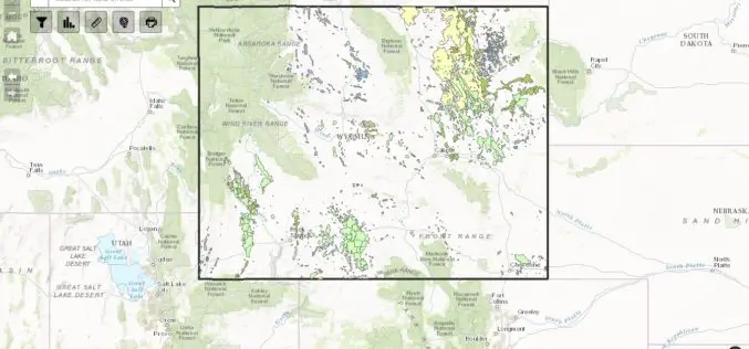
WSGS Completes First Update to Online Oil and Gas Map since its Launch in July
The Wyoming State Geological Survey (WSGS) has completed the first update to its online Oil and Gas Map of Wyoming, including revising the map’s data and improving its functionality. The
OGC seeks public comment on candidate OGC Web Coverage Service 2.0 Interface Standard – Earth Observation Application Profile 1.1
The Open Geospatial Consortium (OGC®) is seeking public comment on its Web Coverage Service 2.0 Interface Standard – Earth Observation Application Profile 1.1. This OGC WCS Application Profile – Earth
AIOFM’s Rapid Online Monitoring LiDAR System Steps into Its Industrialization
With support from special project of national major scientific apparatus “R&D and Application of LIDAR System for Spatial-Temporal Detection of Atmospheric Fine Particle and Ozone”, Anhui Institute of Optics and

NGA Solicits Input for Airborne SAR in Boosting Innovative GEOINT Topic Area
SPRINGFIELD, Va. – The National Geospatial-Intelligence Agency released the fifth topic of the agency’s Boosting Innovative GEOINT, or BIG, Broad Agency Announcement initiative, March 31, focused on airborne synthetic aperture
