
Tag "geospatial"
BAE Systems Enhances Geospatial Software by Adding Movement Intelligence Capabilities
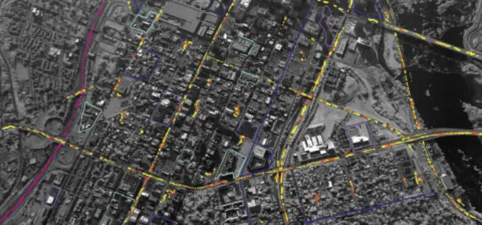
SAN DIEGO–(BUSINESS WIRE)–BAE Systems has integrated capabilities called Movement Intelligence, or MOVINT, into its Geospatial eXploitation Products™ (GXP®) line of software, helping analysts to more easily identify intelligence threats using
DigitalGlobe Makes MDA’s RADARSAT-2 Data Available on the Geospatial Big Data platform
WESTMINSTER, Colo.–(BUSINESS WIRE)–Jun. 5, 2017– DigitalGlobe, Inc. (NYSE: DGI), the global leader in Earth imagery and information about our changing planet, today announced an agreement with MacDonald, Dettwiler and Associates
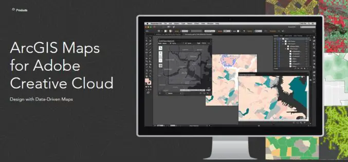
Esri Announce the Release of ArcGIS Maps for Adobe Creative Cloud!
The ArcGIS and Adobe® integration opens GIS up to an expanding group of design- and communications-focused users, who can now make direct use of spatial information. Cartographers can have the
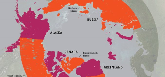
ArcticDEM Project Has Now Mapped More Than 65 Percent of The Arctic
ArcticDEM Release 5 represents the largest release of elevation data to date, more than doubling the number of available strip DEMs, mosaic tiles and geographic coverage area of all releases
Japan Launches Satellite Carrying Its Own Version of GPS
Japan has recently launched a rocket carrying a satellite with a local version of the US global positioning system (GPS) (Quasi-Zenith Satellite System) on Thursday (June 1, 2017), which is expected
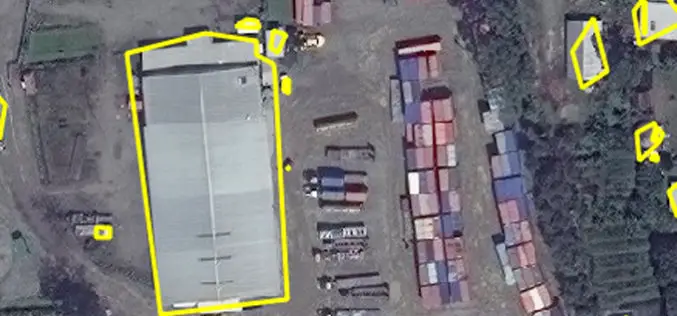
East View Geospatial Enhances Training Data Accuracy for Automated Feature Identification in Machine Learning Trials
MINNETONKA, Minnesota, USA, 1 June 2017 – East View Geospatial (EVG), a provider of content-rich cartographic products, continues to enhance the accuracy of automated feature identification using its newly developed

The Benefits and Challenges of UAVs
Ohio University Online The Federal Aviation Administration predicts that by 2017, the market for military UAVs will surpass $10 billion, while the Association for Unmanned Vehicle Systems International believes that
ISRO to Set up Geospatial Outreach Research Facility in Hyderabad
The Indian Space Research Organisation (ISRO) will set up an outreach facility in Hyderabad, Telangana and it is a matter of pride for the state to be given this research centre.
Airbus Creates New Commercial Drone Services Start-up “Airbus Aerial”
– Launches U.S. base and business, headquartered in Atlanta, Georgia – Starts operations with imagery services fusing drones, satellite images, and software to bring deeper insights to commercial customers –

Global Mapper Mobile Now Available for Android Devices
Blue Marble Geographics is pleased to announce the immediate availability of a beta release of the Android version of its Global Mapper Mobile app. Mirroring the capabilities of the iOS
