
Tag "GIS"
November Update of ArcGIS Online Features
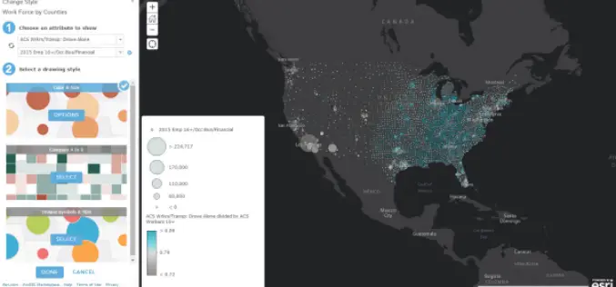
Esri has released the November 2015 update for ArcGIS Online features, which includes new options for visualizing your data, enhancements to administering your organization, and improvements to the design of the
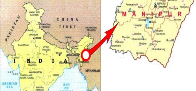
Manipur Has Launched ‘Make In Manipur’ and GIS Mapping for Sericulture Activities
Imphal – Manipur government has launched ‘Make in Manipur’ and GIS mapping for sericulture activities in the region. The move aimed to woo investors and generate employment in the state. Manipur
CartoDB’s Location Intelligence Platform Continues Revolutionizing the Future of Smart Cities
Mexico City and CartoDB unveil the company’s largest civic location intelligence project to date at the Smart City Expo World Congress in Barcelona CartoDB unveiled the initial phases of a
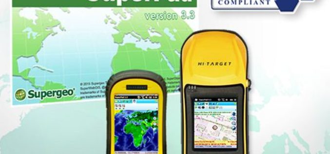
Get Ready for Best Mobile GIS Solution on Windows Mobile Platform Ever!
The product team at Supergeo is getting ready to launch an updated version of SuperPad 3.3! The usability and reliability have been improved, and we have included some robust and
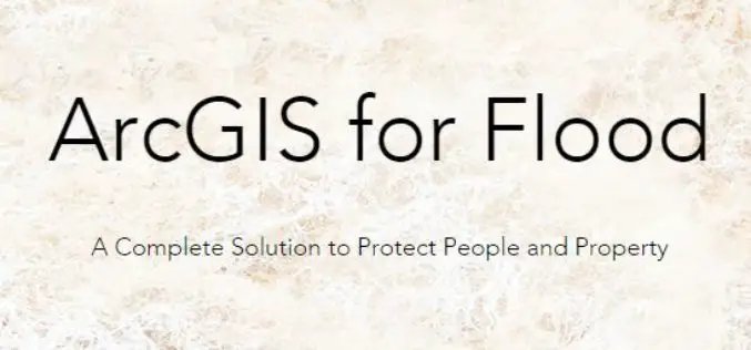
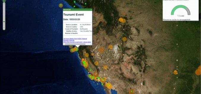
Transform Your Flood Preparedness with ArcGIS
Transform Your Flood Preparedness with ArcGIS Wed, Dec 9, 2015 10:30 PM – 11:30 PM IST Time is running out to prepare for historic weather events fueled by El Niño.
Gain Fine Grain Control to Your Data
When building up a web map platform, it is crucial for developers to be able to control all the GIS layers. With the latest release of SuperGIS Server JavaScript APIs,
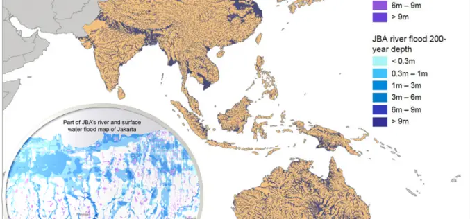
Asian Cities May See Increases in Flood Risk By 2020
Some rapidly growing Asian cities may see increases of up to 36% in the population at risk of extreme river and surface water flooding by 2020, according to recent study
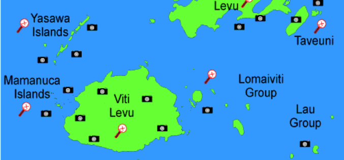
Fiji Government Assures its Commitment to Support Geospatial Industry
The Fijian Government has remained committed to the wide-spread use of geospatial technologies and to bringing Fiji’s existing technologies in line with international standards. Those were the sentiments of Prime
Abu Dhabi to Host Esri Middle East and North Africa User Conference
Emirate Serves as the Smart Government Role Model for All Nations in the Region to Replicate Redlands, California—For almost a decade, Abu Dhabi, United Arab Emirates, has typified smart government—primarily

Vricon Introduces Groundbreaking Medium-resolution Digital Surface Model
November 10, 2015 – Vricon releases a medium-resolution global digital surface model (DSM) for $1.99 per km2 that defines a new industry standard for this product class. Vricon DSM-10 is
