
Tag "GIS"

China Released New Regulations on Maps to Boost Geographic Information Industry
China has released new regulations on maps to boost development of the geographic information industry. The new regulations includes, a new chapter on online map services, as well as new
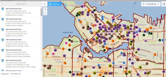
Vancouver Police Department Launch Crime Mapping Tool
The Vancouver Police Department (VPD) has launched a public version of an interactive crime mapping tool called GeoDASH, which officers have been using for about a year now. GeoDASH stands for
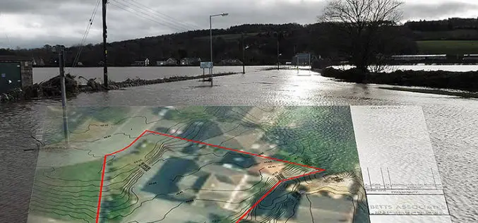
Bluesky’s 3D Aerial Maps Inform Flood Risk Assessments for Planning Applications
Aerial photography and detailed 3D height models are being used to assess the risk of flooding, and help development projects progress through the planning process. Working with Betts Hydro, part
SuperGIS Desktop Supports Italian Waste Management Organization
The global GIS solution and software provider, Supergeo Technologies Inc. announces that ATO2 – Ancona, a regional waste management organization in Italy, has selected SuperGIS Desktop as their solution to

Manchester Wins £10m Prize to Become World Leader in ‘Smart City’ Technology
Ordnance Survey is part of a public – private consortium that is celebrating winning a £10m competition for Manchester to be the UK’s Internet of Things (IoT) Demonstrator, awarded by the
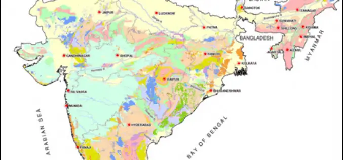
Pilot Project on Aquifer Mapping In Five States
According to recent news, the Government of India has undertaken a pilot project on aquifer mapping in parts of five states. Union Minister of State for Water Resources Sanwar Lal
UN Certificate Course on Geospatial Technologies for Disaster Risk Reduction
Geospatial Technologies for Disaster Risk Reduction in the Horn of Africa Geographic information systems (GIS) can be a very useful tool for the whole disaster management cycle starting from the

New Remote Sensing Handbook Published
A newly published, three-volume “Remote Sensing Handbook” is a comprehensive coverage of all remote sensing topics written by over 300 leading global experts. With 82 chapters, and more than 2000

US Environmental Protection Agency Chooses SimActive’s Correlator3D
SimActive Inc., a world-leading developer of photogrammetry software, has been selected by the United States Environmental Protection Agency (USEPA). They are using Correlator3D™ to create 3D datasets of vegetation for
GRASS GIS 7.0.2 Released
GRASS GIS is pleased to announce the new stable release of GRASS GIS 7.0.2 The new GRASS GIS 7.0.2 release provides 190 stability fixes and manual improvements. About GRASS GIS 7: Its graphical
