
Tag "GNSS"
DGCA to Airlines: Use GAGAN or Face Consequence
Mumbai – According to recent news by the Mumbai Mirror, the government has warned domestic airlines of `consequences’ if they did not adopt the Rs 774 crore GPS-Aided Geo Augmented

TBC Power Hour – UAS Processing using new TBC/UASMaster Workflows
TBC Power Hour Webinar: UAS Processing using new TBC/UASMaster Workflows Dec 21, 2016 | 8 AM MDT or 4 AM MDT UAS (Unmanned Aerial Systems) are becoming part of daily

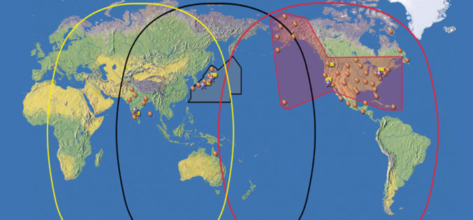
NASA’s CYGNSS Launch Takes Surrey Satellite’s Space GNSS Receiver into Orbit
ENGLEWOOD, COLO. — Surrey Satellite Technology’s Space GNSS Receiver Remote Sensing Instrument (SGR-ReSI) is the primary payload onboard NASA’s CYGNSS constellation, launched today, December 15. The Cyclone Global Navigation Satellite System

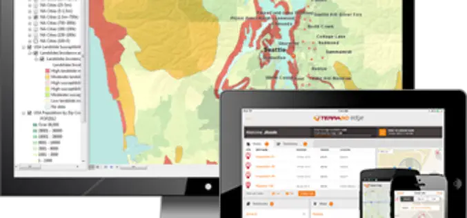
Take Trimble GNSS to the Cloud with TerraGo Edge
Take Trimble GNSS to the Cloud with TerraGo Edge Date: Tuesday, December 13, 2016 Time: 12:00 PM (ET) TerraGo Edge now includes the Trimble GNSS Direct SDK enabling professional-grade positioning

uAvionix Partners With PrecisionHawk To Add On-Board Ads-B To LATAS Enabled Drones
Palo Alto, CA – November 16, 2016 – uAvionix and PrecisionHawk today announced a plan to jointly develop the next generation of LATAS hardware. The integration of the uAvionix Ping ADS-B
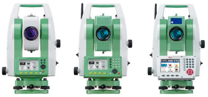
Leica Geosystems Acquires M&P Survey in the UK
In March 2016, Hexagon Geosystems, business division of Hexagon including Leica Geosystems, acquired M&P Survey Equipment Limited – one of the UK’s leading Leica Geosystems distributors. Since then, Hexagon Geosystems
TerraGo Webinar: Connect your ArcGIS with the Edge of the Enterprise
Webinar: Connect your ArcGIS with the Edge of the Enterprise November 15, 2016 | 12:00 PM (ET) Maximize your ArcGIS investment and reach a wider mobile audience, while improving field data
New Leica iCON Roller Secures Long-lasting Quality, Improves Productivity
Leica Geosystems, industry leader in measurement technology, released today (27 September 2016) its new iCON roller, providing contractors with the solution to achieve constant and effective compaction on any work
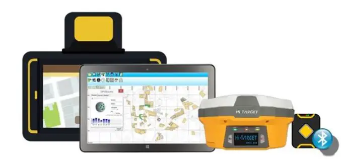
Collect Field Data with High Accuracy – Supergeo X Hi-Target
Supergeo provides GIS software on multiple platforms, including server, desktop, and mobile. Due to the rapid development of the mobile and smart devices in recent years, Supergeo has been dedicated

Conducting a More Precise Fieldwork
Receiving high accuracy data is the ultimate goal of fieldworkers and surveyors. Now, two core products of SuperGIS Mobile Series: SuperSurv for Android and SuperPad are all capable of receiving
