
Tag "GPS"
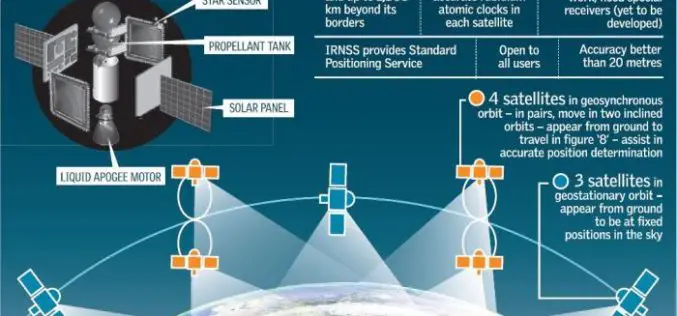
Isro to Sign MoU with CSIR-NPL for Time and Frequency Traceability Services for NavIC
According to recent news reported by TOI, the Indian Space Research Organisation (ISRO) will on Friday sign an MoU with CSIR-National Physical Laboratory (NPL) for time and frequency traceability services. The move

TerraGo Mobile Apps Add New Advanced Mapping Features and Laser Range Finder Integration
TerraGo Mobile Apps Add New Advanced Mapping Features and Laser Range Finder Integration TerraGo Edge 4.1 and any app created with the TerraGo Magic zero-code app platform includes enhanced mapping and surveying features
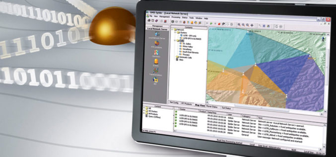
Leica Geosystems’ GNSS Networks Now Support Galileo, QZSS
(Heerbrugg, Switzerland, 16 June 2017) Leica Geosystems, industry leader in measurement technology, released Leica Spider v7.0 software suite, supporting Galileo and QZSS constellations as well as the GPS-L5 signal for

Ministry of Public Works of Indonesia Selects SuperSurv
With the assistance of Supergeo’s reseller in Indonesia- GPS Lands Indosolutions, the Ministry of Public Works and Housing (Kementerian PUPR) of Indonesia has selected SuperSurv for their tasks of spatial
Japan Launches Satellite Carrying Its Own Version of GPS
Japan has recently launched a rocket carrying a satellite with a local version of the US global positioning system (GPS) (Quasi-Zenith Satellite System) on Thursday (June 1, 2017), which is expected

Japan to Introduce GPS Satellite to Jam North Korean Signals
According to recent news, Japan will launch GPS satellite that will have GPS jamming capabilities for North Korean signals. The jamming functions are to be included on the Japanese GPS satellite Michibiki

SuperSurv Selected by Agricultural Company Socfinco
The global GIS software provider Supergeo Technologies Inc. is delighted to announce that its cutting-edge mobile GIS software SuperSurv has been chosen by Socfinco, the agricultural company. Located in Brussels,
ISRO Develops “Solar Calculator” Android App
Computation of solar energy potential is essential to select the locations for solar photovoltaic (PV) thermal power plants. The use of remote sensing observations from geostationary satellite sensors is ideal to capture

NASA Awards Very Long Baseline Interferometry Support Services
GREENBELT, Md., March 30, 2017 /PRNewswire-USNewswire/ — NASA has awarded the follow-on contract for Very Long Baseline Interferometry (VLBI) Support Services to NVI, Inc., of Greenbelt, Maryland. This is a
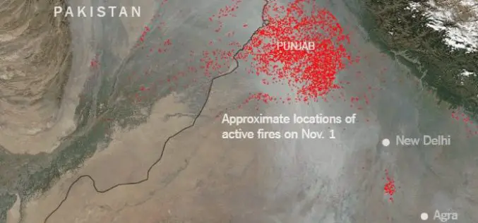
Punjab to use Remote Sensing and SMS Technology to Battle Against Crop Residue Burning
According to recent news reported by the Times of India, Punjab is set to make its battle against crop residue burning real time, with the state authorities using geospatial data
