
Tag "GPS"

NASA Engineers Demonstrated X-ray Navigation in Space
According to recent news by NASA, a team of NASA engineers has demonstrated fully autonomous X-ray navigation in space — a capability that could revolutionize NASA’s ability in the future to
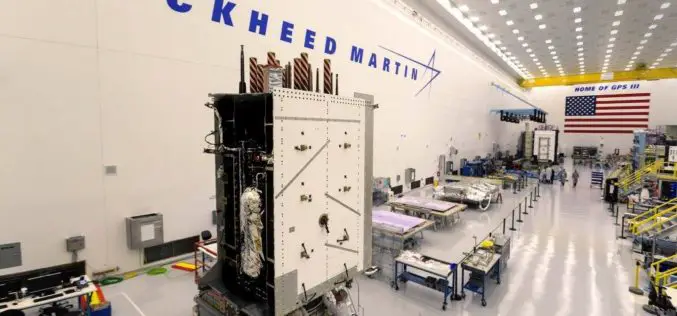
Harris Corporation Delivers Fourth GPS III Satellite Navigation Payload; Establishes Full Production Cadence
Highlights: Completes fourth delivery of ten navigation payloads for Lockheed Martin’s GPS III satellites Advanced payload increases power, accuracy, flexibility and lifespan Harris navigation technology on every GPS satellite; 800-plus
NovAtel’s GPS Anti-Jam Technology Selected for the United Kingdom’s Type 26 Frigate
Calgary, Canada, November 29, 2017 – NovAtel® announced today that its GPS Anti-Jam Technology (GAJT®) has been selected for the United Kingdom’s Type 26 Frigates to meet a requirement as part
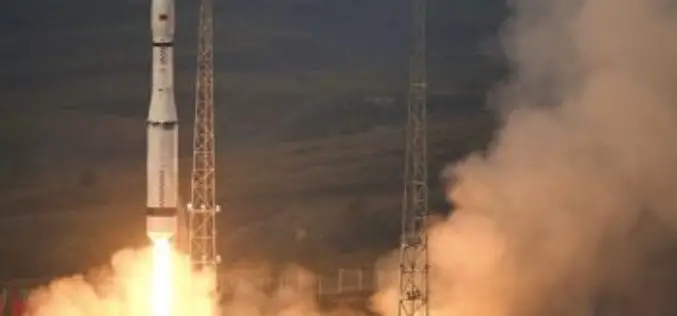
Launch of China’s New-Generation Beidou-3 Navigation Satellites
November 5, 2017 – According to recent news, China has successfully launched two navigation satellites – namely the Beidou-3M1 (Beidou-24) and Beidou-3M2 (Beidou-25) navigation satellite using a Long March-3B/YZ-1 rocket. The satellites are
GPSdome to Announce GPS Anti-Jamming & Anti-Spoofing Antenna Module Solution for Timing Systems at ITSF
CAESAREA, Israel, October 30, 2017 /PRNewswire/ — GPSdome Ltd., the Cyber Company, announced the release of its new product, GPSdome 1.0 Model T, which provides GPS anti-jamming and anti-spoofing protection for GPS-based timing systems.

Japan Successfully Launches 4th Satellite of Quasi-Zenith Satellite System (QZSS)
October 10, 2017 – Mitsubishi Heavy Industries, Ltd. and JAXA successfully launched H-IIA Launch Vehicle No. 36 (H-IIA・F36) which encapsulates MICHIBIKI No. 4, Quasi-Zenith Satellite System; at 7:01:37a.m., 2017 (JST) from
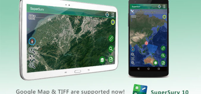
SuperSurv 10.1 Supports New Raster Formats and Online Maps
As the information technology constantly evolves, the geospatial industry also grows fast. Currently, including many open source projects, numerous services are providing online maps to geospatial professionals. As professional and

Indian Railways to Install GPS in all Hand-pushed Trolleys Used for Track Inspection
September 8, 2017 – PTI – The railway ministry has decided to install GPS trackers in all hand-pushed trolleys used to inspect the tracks. In a letter to all zonal
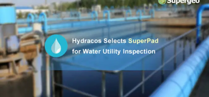
Hydracos Selects SuperPad for Water Utility Inspection
Supergeo is pleased to announce that SuperPad, the mobile GIS software integrates GIS and GPS positioning technologies perfectly, is earlier selected by French company Hydracos with the assistance of Supergeo’s

Trimble Webinar: TBC Power Hour – Network Adjustment vs. Traverse Adjustment
TBC Power Hour – Network Adjustment vs. Traverse Adjustment AUGUST 30, 2017 | 08am MT or 04pm MT Geospatial Webinars offer attendees the opportunity to learn more about products, explore
