
Tag "GPS"
Is Britain on the move?
Australia has recently announced a 1.8m shift in its mapping coordinates, to compensate for the country’s 7.5cm shift north each year. Inevitably the question is why, and could the same

Esri and Leica Partner to Offer Grants to Governments
Smart Communities Innovation Challenge Provides Support for Improving Mobile Government Redlands, California—Geographic information system (GIS) provider Esri has partnered with Swiss-based spatial measurement instrument manufacturer Leica Geosystems to encourage innovation
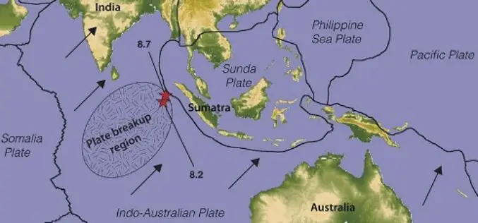
Australia’s Coordinates out by More Than 1.5 m
The Australian continent tectonic plate is moving 7 cm a year (and colliding with the Pacific Plate, which is heading west 11 cm a year) and experts at Geoscience Australia
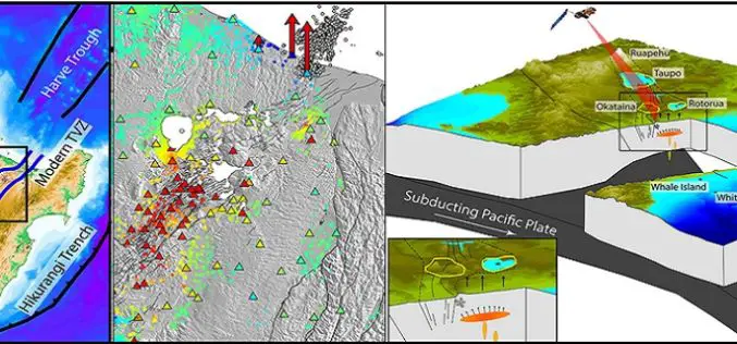
GPS and Satellite Radar Interferometry Indicate the Birth of a New Magma Body Beneath New Zealand
A recent study by Ian Hamling using Global positioning satellite and satellite radar interferometry measurements has indicated the birth of a magma chamber along the Taupo Volcanic Zone. Magma is a

GPS and Satellite Mapping Technology to Monitor the Forest Cover
Maharashtra, India – Maharashtra government will use Global Positioning System (GPS) and satellite mapping technology to monitor the forest cover in the state. “The government will use GPS and satellite

India-Nepal Border Pillars to be GPS-enabled
KATHMANDU: More than 8,000 pillars along the India-Nepal border will be linked to a Global Navigation Satellite System, allowing authorities for the first time to effectively manage the over 1,700-km-long

A New Mobile Phone App for Grassroots Mapping
University of Exeter academics have created an app which could help aid humanitarian rescue work in disaster-struck regions by using geographic data to map landscapes. The android mobile phone application
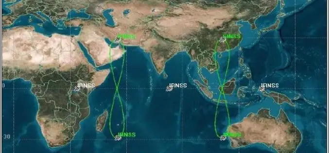
PSLV-C33 Successfully Launches India’s Seventh Navigation Satellite IRNSS-1G
Apr 28, 2016 – In its thirty-fifth flight (PSLV-C33), ISRO’s Polar Satellite Launch Vehicle successfully launched the 1425 kg IRNSS-1G, the seventh satellite in the Indian Regional Navigation Satellite System (IRNSS)

Launch of Nationwide Emergency Response System
April 26, 2016 – New Delhi- The “Nationwide Emergency Response System” project that seeks to establish a modern emergency response system by connecting police with the citizens. It includes integrating

Leica Geosystems Smart Antenna Provides Superior Performance
Static, long term projects requiring a high number of sensors now have a new affordable smart antenna. This same device can also enable dynamic monitoring with up to 10 Hz data
