
Tag "High resolution"

Airbus Defence and Space Invests in Very High-Resolution Satellite Imagery from 2020 Onwards
-Four very high-resolution (VHR) optical Earth observation satellites to be launched in 2020 and 2021 will ensure continuity of Pléiades misión – Highly responsive dual VHR constellation will offer state-of-the-art
Scientists Explore Earth’s Newest Land Using Advanced, High-Resolution 3D Mapping
SUVA, FIJI – Research vessel (R/V) Falkor will return to port today after 28 days at sea conducting pioneering studies including mapping the Earth’s newest island landscape in the Kingdom

China Launches Gaofen 8 Earth Observation Satellite
In recent news, China has successfully launched the Gaofen 8, a high resolution optical remote sensing satellite into a scheduled near-circular orbit with an average altitude of around 473 kilometers, or

Full Waveform LiDAR Sample Data Now Available For Free
In a recent announcement by NEON, NEON Airborne Observation Platform (AOP) sample data is now available on the Airborne Data page. The NEON Airborne Observation Platform (AOP) is an aircraft
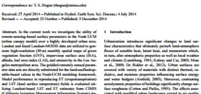
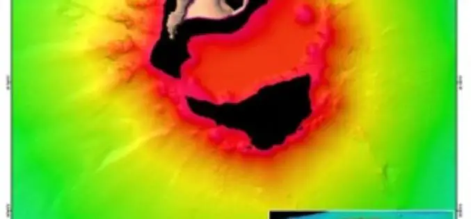
High-Resolution Land Surface Modeling Utilizing Remote Sensing Parameters and the Noah UCM: A Case Study in the Los Angeles Basin
High-Resolution Land Surface Modeling Utilizing Remote Sensing Parameters and the Noah UCM: A Case Study in the Los Angeles Basin – P. Vahmani and T. S. Hogue Abstract: In the
