
Tag "Hyperspectral remote sensing"
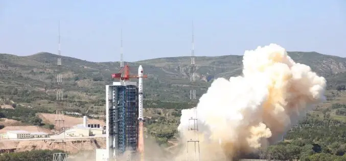
China Launches Hyperspectral Remote Sensing Satellite – Gaofen-5 02
China successfully launched the Gaofen-5 02 into space from the Taiyuan Satellite Launch Center in northern Shanxi Province on September 07, 2021. The satellite was launched using the Long March-4C

PhD Studentship in Hyperspectral Remote Sensing
Cranfield University is a British postgraduate and research-based university specialising in science, engineering, technology and management. It contains two campuses; the main campus is at Cranfield, Bedfordshire, and the second is the

5th EnMAP School on Hyperspectral Remote Sensing
The EnMAP Science Advisory Group (EnSAG) organizes the 5th EnMAP School at Trier University in April 2016. We are pleased to host the EnMAP School in Trier for the second

Hyperspectral Remote Sensing Reveals New Blind Geothermal System
Identification of a new blind geothermal system with hyperspectral remote sensing and shallow temperature measurements at Columbus Salt Marsh, Esmeralda County, Nevada Hyperspectral remote sensing-derived mineral maps and follow-up shallow
NRSC Announces Course on Hyperspectral Remote Sensing
National Remote Sensing Agency (NRSA) was established as a registered society on 2nd September 1974 by Department of Science & Technology, based on a Union Cabinet approval dated December 13,
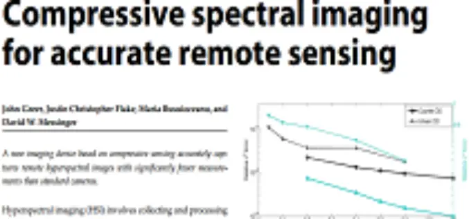
Compressive Spectral Imaging for Accurate Remote Sensing by John Greer et al.
Compressive Spectral Imaging for Accurate Remote Sensing by John Greer, Justin Christopher Flake, Maria Busuioceanu and David W. Messinger Abstract: Hyperspectral imaging (HSI) involves collecting and processing information to generate a spatial map
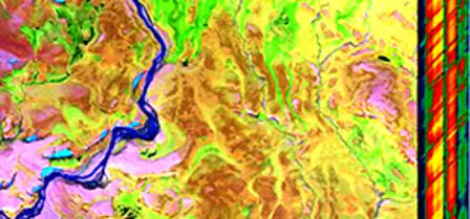
Fundamemtals of Hyperspectral Remote Sensing
Introduction Hyperspectral remote sensing is the science of acquiring digital imagery of earth materials in many narrow contiguous spectral bands. Hyperspectral sensors or imaging spectrometers measure earth materials and produce

Hyperspectral Remote Sensing
Hyperspectral remote sensing is the science of acquiring digital imagery of earth materials in many narrow contiguous spectral bands. Hyperspectral sensors or imaging spectrometers measure earth materials and produce complete spectral
