
Tag "LiDAR"
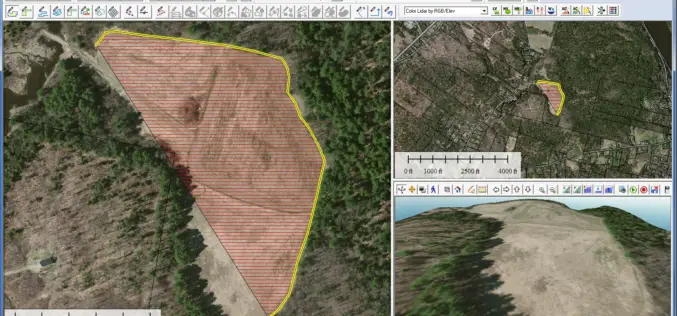
Global Mapper 17.2 Released with New Map Book Creation Tool and Cutaway Terrain View
Hallowell, Maine – May 17, 2016 – Blue Marble Geographics (bluemarblegeo.com) is pleased to announce the immediate availability of Global Mapper version 17.2. This upgrade to the version 17 release
Cardno Files U.S. Patent Application for UAS Remote Sensing Process
New patent application filing for Unmanned Aerial Systems UAS remote sensing technology workflow to support abandoned uranium assessment and cleanup. Cardno announced the filing with the U.S. Patent & Trademark Office
Orbit GT Launches New UAS Mapping Software at SPAR
April 11, 2016 – Orbit GT will be launching new UAS Mapping software at the upcoming SPAR event in Houston, USA. “We’re very pleased to announce that our UAS Mapping
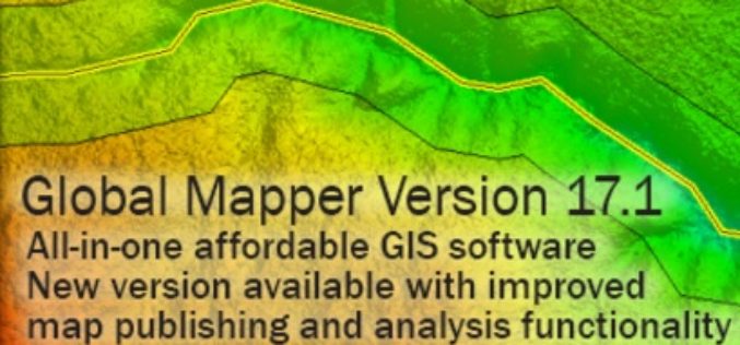
Global Mapper SDK v17.1 Released with Updates and Performance Improvements throughout the Toolkit
Hallowell, Maine – March 31, 2016 – Blue Marble Geographics (bluemarblegeo.com) is pleased to announce the immediate availability of version 17.1 of the Global Mapper Software Development Kit (SDK) along
Blue Marble Names Global Mapper Best Commercial GIS Software Available for $499
Hallowell, Maine – Blue Marble Geographics (bluemarblegeo.com) is pleased to announce that they have named Global Mapper the best commercial GIS software available for $499. Blue Marble’s geospatial data manipulation,
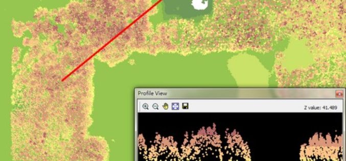
Put Your LiDAR Data on the GIS Platform!
By rapidly collecting massive data from the surface, LiDAR technology has dramatically changed the geospatial industry. LiDAR data can record much information delicately such as the elevation, the spectrum, and
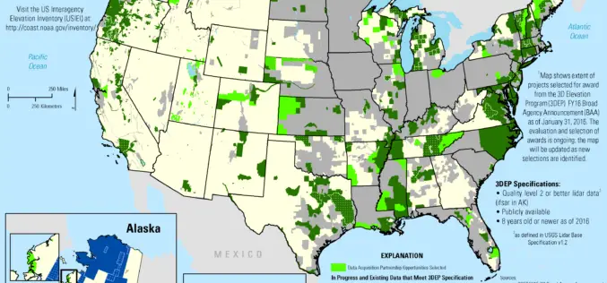
2016 Lidar Partnership Awards Announced
The U.S. Geological Survey has announced the first recipients of the 2016 partnership funding awards for the 3D Elevation Program. This program, referred to as 3DEP, presents a unique opportunity

World Campus Remote Sensing Certificate Helps GIS Professionals Use Drone Data
UNIVERSITY PARK, Pa. — Drones are suddenly everywhere — gathering crop data, monitoring air pollution, helping with search-and-rescue missions and even taking “drone selfies.” But the increase of data collection
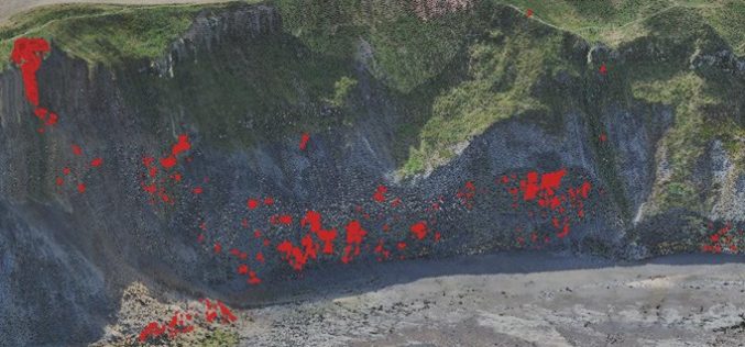
Monitoring Coastal Instability using Airborne and Terrestrial LiDAR
Unstable and rapidly eroding coastlines can cause risk to local infrastructure, and as such, it is important to gain a deeper insight and knowledge into the exact movements and erosion
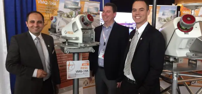
NEW RIEGL High-Speed Mobile Mapping Turnkey Systems Launched at ILMF 2016!
Introducing the latest advancements in RIEGL LiDAR Technology for mobile applications: NEW RIEGL High-Speed Mobile Mapping Turnkey Systems Launched at ILMF 2016! On February 22 at ILMF 2016 in Denver, RIEGL launched
