
Tag "mapping"
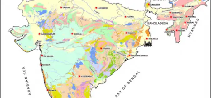
Pilot Project on Aquifer Mapping In Five States
According to recent news, the Government of India has undertaken a pilot project on aquifer mapping in parts of five states. Union Minister of State for Water Resources Sanwar Lal

HERE to Explore Use of Big Data
The consortium of carmakers consisting of Audi, BMW and Daimler that owns digital map maker HERE said on Monday it would explore the use of big data to improve the

Low-flying Airplane Mapping Geology and Mineral Resources Over the Eastern Adirondacks
Residents of Essex and Clinton counties in New York may notice an airplane flying a grid pattern at low altitude for a few weeks in December as scientists from the
Bhuvan Tamil Nadu FS: A Mobile App to Monitor Flood Situation
Bhuvan Tamil Nadu FS App is a user-friendly mobile application which enables to collect and report for geo-tagged of flood information on various parameters such as type of damage and
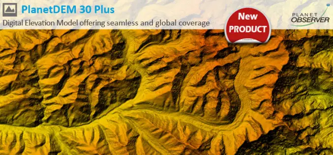
PlanetDEM 30 Plus: The New Global Digital Elevation Model at 30-Meter Resolution Offering Seamless, Reliable and Accurate Data
PlanetObserver, specialist of geospatial data production for more than 25 years, announced today the release of PlanetDEM 30 Plus global elevation model. PlanetDEM 30 Plus is the new Digital Elevation
UN Certificate Course on Geospatial Technologies for Disaster Risk Reduction
Geospatial Technologies for Disaster Risk Reduction in the Horn of Africa Geographic information systems (GIS) can be a very useful tool for the whole disaster management cycle starting from the

New Remote Sensing Handbook Published
A newly published, three-volume “Remote Sensing Handbook” is a comprehensive coverage of all remote sensing topics written by over 300 leading global experts. With 82 chapters, and more than 2000

CIDCO to Fight Encroachments Using Satellite Mapping
Navi Mumbai: The City and Industrial Development Corporation of Maharashtra (CIDCO) has tied up with a Central government agency, which will provide satellite mapping every fortnight keeping an eye on
Geovation Water Challenge Launches
Funding for innovation that improves our relationship with water. Ordnance Survey’s ninth Geovation® Challenge launched on 1 December, and sees Britain’s mapping agency offering development funding and places on its Geovation
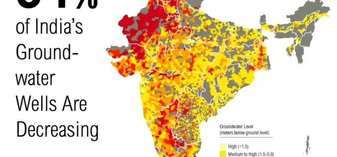
Government to Expedite the Task of Groundwater Mapping
New Delhi – The Government of India has decided to speed up the task of mapping of aquifers for better management of groundwater. Mapping of underground water source is expected to
