
Tag "Mobile Mapping"
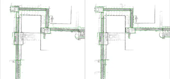
NavVis Sets New Standard in SLAM Precision
New algorithm reduces drift error in indoor environments MUNICH, Germany, 7 February 2018 – NavVis, a global leader in mobile indoor mapping, visualization, and navigation, announces new mapping software that significantly improves the

Leica Geosystems Multipurpose Mobile Mapping Platform Increases Smart City Applications
Leica Pegasus:Two Ultimate enables professional 360-degree seamless imagery Heerbrugg, Switzerland, February 06, 2018 – Leica Geosystems, industry leader of measurement technology, released today the new Leica Pegasus:Two Ultimate, an upgrade to

GeoSLAM Celebrates Five Years in Business with New HQ, Record Growth
Nottinghamshire, U.K. 13 December 2017 – Leading 3D mobile mapping technology specialist, GeoSLAM, is on track to achieve its growth ambitions in 2018 after relocating to new UK headquarters. The Nottinghamshire-based

TerraGo Edge Version 4.2 Enhances Field User Experience and Mobile Mapping
December 4, 2017 – TerraGo is happy to announce the availability of TerraGo Edge Version 4.2 and any app created with the TerraGo Magic zero-code app platform includes enhancements to the user experience that accelerate

GeoSLAM and Bentley Systems Join Forces to Take Mobile Reality Modelling Indoors
BENTLEY YII 2017, SINGAPORE, OCTOBER 5, 2017 – GeoSLAM – the experts in “go anywhere” 3D mobile mapping technology, and Bentley Systems, a leading global provider of comprehensive software solutions for advancing infrastructure,

TerraGo Mobile Apps Add New Advanced Mapping Features and Laser Range Finder Integration
TerraGo Mobile Apps Add New Advanced Mapping Features and Laser Range Finder Integration TerraGo Edge 4.1 and any app created with the TerraGo Magic zero-code app platform includes enhanced mapping and surveying features
Trimble Business Center v3.90 Now Available
Trimble Business Center provides users with the capability to efficiently edit, process, and adjust geospatial data and create deliverables with confidence. The New features/updates included in TBC v3.90: Create, edit,
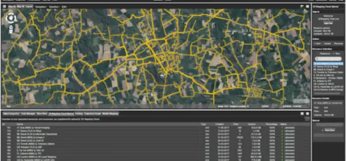
Orbit GT Releases Mobile Mapping Content Manager v17.1 With Cloud Upload Feature
Orbit GT releases v17.1 of its industry-leading Mobile Mapping Content Manager product including the all-new Upload to the Cloud feature. It is available for download today from our website www.orbitgt.com.
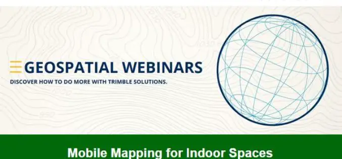
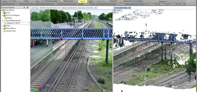
Trimble Geospatial Webinar “Mobile Mapping for Indoor Spaces” Featuring TIMMS
Trimble Geospatial Webinar “Mobile Mapping for Indoor Spaces” Featuring TIMMS 08am MT/ 4pm MT | MAY 17, 2017 Take a ride through the entire workflow of Trimble’s Indoor Mobile Mapping

Velodyne LiDAR Announces Breakthrough Design for Miniaturized, Low-Cost Solid-State LiDAR Sensors
Application of integrated circuitry leads to a new approach to LiDAR sensors for the autonomous vehicle, 3D mapping, and drone industries MORGAN HILL, Calif.–(BUSINESS WIRE)–Velodyne LiDAR Inc., the recognized global
