
Tag "NavIC"
What is GNSS Reflectometry? How Does GNSS Reflectometry Work? Understanding Its Principles and Applications
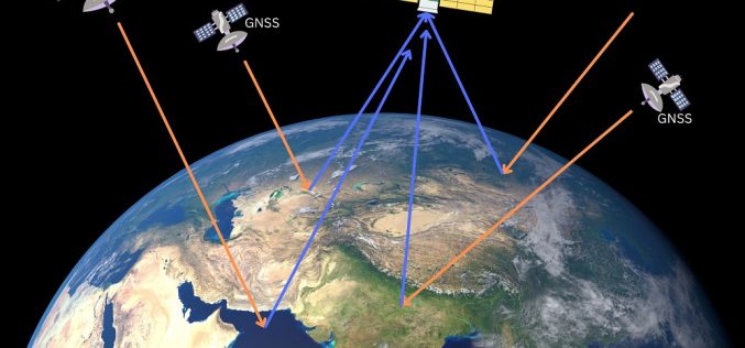
GNSS Reflectometry (GNSS-R) is an innovative remote sensing technique that leverages signals from Global Navigation Satellite Systems (GNSS) reflected off the Earth’s surface. Originally designed for navigation and geodetic applications,

Call for Proposals for Geospatial Technology and Solutions: Impact and Importance for India’s Future
The National Geospatial Programme (NGP) division, formerly NRDMS, calls for proposals in Geospatial Technology and Solutions that have the potential to impact various sectors in India significantly. The National Geospatial

Indian Satellite Navigation Policy (SATNAV Policy) – 2021 to Achieve Self-Reliance in Satellite-Based Navigation and Augmentation Services
Department of Space being the administrative Ministry/Department in respect of space activities in India has released a draft of “Indian Satellite Navigation Policy (SATNAV Policy) -2021.” The policy has been
Hexagon Positioning Intelligence Introduces PIM7500 for Autonomous Applications
Bertrandt selects the PIM7500, seen as the “Perfect Fit”, to integrate into their platform to power an autonomous commuter bus. Calgary, Canada – 24 May 2018 – Hexagon’s Positioning Intelligence division is
Why India’s Own GPS System 7 Years Late Despite 90% of Funds Allocated Spent
According to recent news by The Asian Age, a report put forward by the Comptroller and Auditor General (CAG) which has pointed at ‘laxity’ on part of the premier space agency
Isro to Sign MoU with CSIR-NPL for Time and Frequency Traceability Services for NavIC
According to recent news reported by TOI, the Indian Space Research Organisation (ISRO) will on Friday sign an MoU with CSIR-National Physical Laboratory (NPL) for time and frequency traceability services. The move
