
Tag "Orthorectification"
Get More from Imagery Using 30 New Features Released to Geomatica Banff
PCI Geomatics has announced the release of over 30 new features and enhancements to photogrammetry and remote sensing solution, Geomatica Banff.

PCI Geomatics Releases GXL 2016
MARKHAM, Ontario, Canada – March 1, 2016: PCI Geomatics, a world leading developer of remote sensing and photogrammetric software and systems, announced today the release of its GeoImaging Accelerator (GXL)

Webinar: Generating Point Clouds with SimActive Correlator3D Version 6.1
Generating Point Clouds with SimActive Correlator3D Version 6.1 Wednesday, April 15, 2015 10:00 pm (Eastern Daylight Time) Correlator3D Version 6 introduced a revolutionary new interface for streamlined image processing of
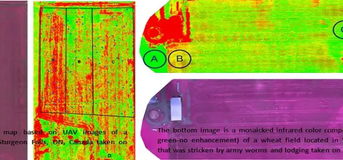
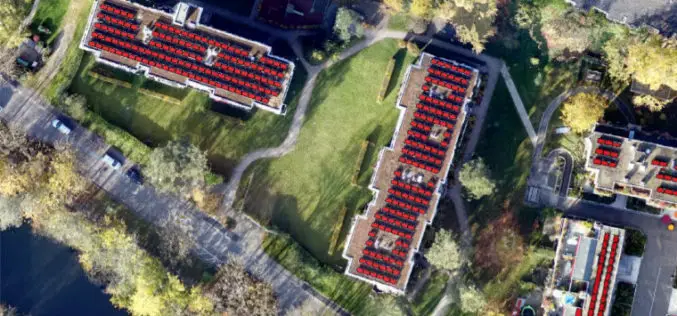
Applications of Low Altitude Remote Sensing in Agriculture
In a study by Chunhua Zhang et. al., on “Applications of Low Altitude Remote Sensing in Agriculture upon Farmers’ Requests– A Case Study in Northeastern Ontario, Canada” reveals the importance
What’s New in ENVI 5.1?
Yesterday I got my first hand on experience with the ENVI 5.1, image processing software. Loaded with lots of many new features and with a new user interface. The
