
Tag "remote sensing"

Maharashtra Government to Spend INR 260 Crore for GIS Mapping of ULBs
According to recent news by TOI – The state cabinet on Tuesday sanctioned Rs 260 crore for GIS mapping(Geographic Information System) of all the C and D municipal corporations, Councils
Odisha Government Includes 7 Kharif Crops Under PMFBY Insurance
According to recent news by the Outlook, Odisha government has recently decided to include seven major crops – paddy, groundnut, cotton, turmeric, ginger, red-gram (arhar) and maize – under the
World’s Largest Satellite Fleet Owner Joins The Geological Remote Sensing Group
The Geological Remote Sensing Group (GRSG) has expanded its membership once again with the recent news that Planet; the owners and operators of the world’s largest commercially-operated fleet of satellites
University of Guelph: Prof. John Lindsay Develops Whitebox Geospatial Analysis Tools for Processing Geospatial Data
Professor John Lindsay has developed a one-of-a-kind software package called Whitebox Geospatial Analysis Tools for processing geospatial data that he says has put the University of Guelph on the map

Space Flight Laboratory (SFL) to Discuss Successful Remote Sensing SmallSat Missions at IAA Berlin
TORONTO, Ontario, Canada, 19 April 2017 – Space Flight Laboratory (SFL), a provider of complete microspace missions, will present papers on the successful GHGSat-D greenhouse gas monitoring and CanX-7 aircraft
KARI and SIIS Announce Starting KOMPSAT DRS (Direct Receiving Station) Service in DLR
KARI (Korea Aerospace Research Institute, www.kari.re.kr) and SIIS (SI Imaging Services, www.si-imaging.com) are very pleased to announce that on April 1, we began to offer KOMPSAT (Korean Multi-Purpose Satellite) DRS
Global Push for Earth Observations Continues
The Group on Earth Observations (GEO) has been working for more than a decade to open access to Earth observation data and information, and increase awareness around their socioeconomic value.
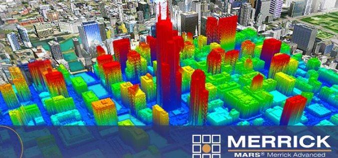
Merrick Releases MARS® 2017 Software Suite
Merrick & Company, a global leader in light detection and ranging (LiDAR), digital orthophotography, hyperspectral imaging, and geographic information systems (GIS) data integration, is pleased to announce the release of
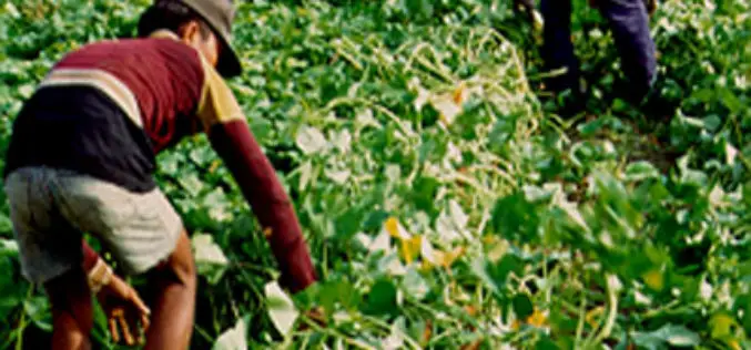
Geo-tagging of Agricultural Land for Crop Management
According to recent by The Pioneer, the Ministry of Agriculture is going to sign a Memorandum of Understanding (MoU) with National Remote Sensing Center (NRSC), ISRO, for geo-tagging every piece
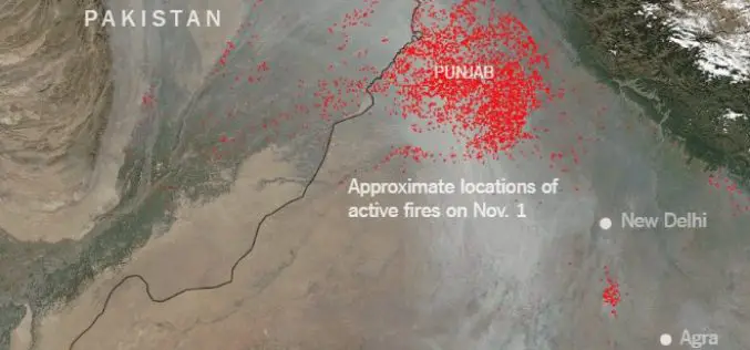
Punjab to use Remote Sensing and SMS Technology to Battle Against Crop Residue Burning
According to recent news reported by the Times of India, Punjab is set to make its battle against crop residue burning real time, with the state authorities using geospatial data
