
Tag "remote sensing"

South Dakota State University Ranks 27th in World for Remote Sensing Research
AUGUST 21, 2017 – South Dakota State University was ranked 27th worldwide and 7th in the United States for research productivity in the area of remote sensing, according to ShanghaiRanking’s 2017
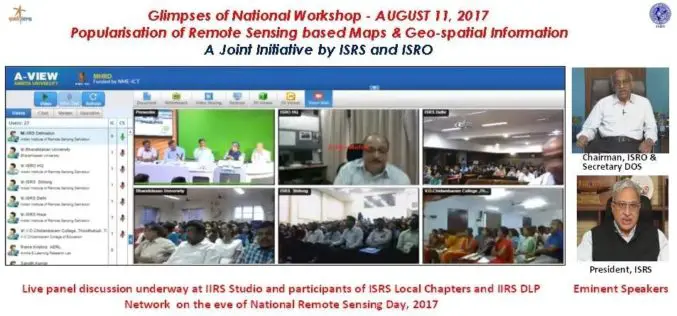
National Workshop on Popularisation of Remote Sensing Based Maps and Geo-spatial Information
August 22, 2017 – A National Workshop on Popularisation of Remote Sensing Based Maps and Geo-spatial Information was organised jointly by ISRS and ISRO on the eve of National Remote Sensing
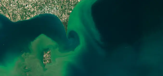
ARSET NASA Webinar: Introduction to Remote Sensing of Harmful Algal Blooms
Webinar: Introduction to Remote Sensing of Harmful Algal Blooms Dates: Tuesday, September 5, 2017 to Tuesday, September 26, 2017 Times: 11:00–12:00 and 21:00–22:00 EDT (UTC-4) Harmful algal blooms (HABs) can have a negative
INTERGEO – Bridge to a Digital Future
Karlsruhe/Berlin, 24, July 2017 | When Geo IT experts from the worlds of business and science sat down together at a roundtable for INTERGEO and got talking, they put together
USGIF Universal GEOINT Certification Program
USGIF has launched a first-of-its-kind, transparent, and transportable Universal GEOINT Certification Program and professional designation that proves your deep and balanced understanding of the GEOINT tradecraft. The goal of the Universal GEOINT Certification Program is to provide
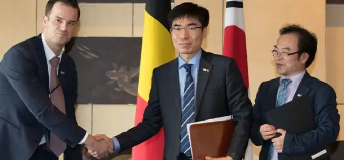
SI Imaging Services Signs MoU with Luciad NV in Belgiumand G-Ros in Korea
On June 14th at the Grand Hyatte Seoul, the SI Imaging Services has signed a Memorandum of Understanding (MoU) with the Luciad NV in Belgium and its certified reseller in

NASA ARSET Training: Introduction to Synthetic Aperture Radar
NASA ARSET Training: Introduction to Synthetic Aperture Radar Dates: Wednesday, June 28, 2017 to Thursday, July 6, 2017 Times: 12:00-1:00 p.m. and 9:00-10:00 p.m. EDT (UTC-4) Introduction: A limitation of optical satellite remote
Excellence in space – 10 years of TerraSAR-X
The TerraSAR-X satellite has been in service for twice the planned time. The data has been providing valuable insights regarding changes to the Earth’s surface for the past 10 years.

Airbus and CSTARS Provide “WorldDEM Ocean Shoreline” for Uniquely Accurate Coastline Mapping
Homogeneous, gap-free and single source vector product delineates world’s ocean shorelines detailed and up-to-date Friedrichshafen, 29 May 2017 – Airbus Defence and Space expands its WorldDEM portfolio with the launch

At Least 15 Russian Remote Sensing Satellites to Operate by 2020
Russian President Vladimir Putin stated that the remote sensing technologies must be used to boost the Russian defense and security, develop the economy and social sphere, and increase the quality
